Gornja Maoča
| Gornja Maoča | |
|---|---|
| Village | |
 Gornja Maoča | |
| Coordinates: 44°43′51″N 18°37′51″E / 44.73083°N 18.63083°E | |
| Country | Bosnia and Herzegovina |
| Political division | Brčko District / Federation of BiH |
| Municipality | Brčko / Srebrenik |
| Government | |
| • Type | Theocracy |
| • Leader | Nusret Imamović |
| Population (2010) | |
| • Total | c. 100[1] |
| Time zone | CET (UTC+1) |
| • Summer (DST) | CEST (UTC+2) |
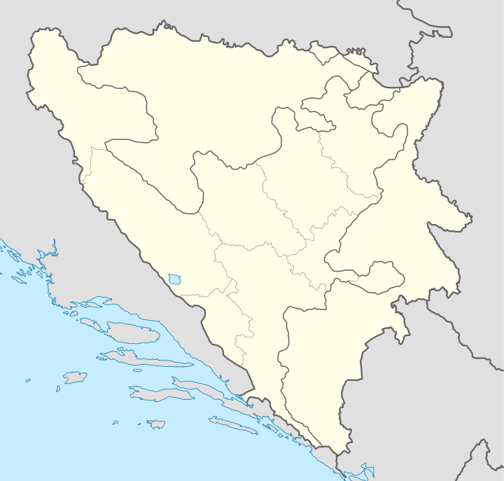
Gornja Maoča (earlier known as Karavlasi) is a village in northeastern Bosnia that territorially belongs to the Brčko District, but administrativelly it belongs to the Srebrenik municipality, Tuzla Canton in the Federation of Bosnia and Herzegovina. It is a mountainous village of Majevica and it's located southern from the village of Maoča. The name of the village can be translated as "Upper Maoča".
The village is known for being a centre of the foreign and domestic Wahhabists, a radical Muslim group, most of whom were former volunteers of the El Mudžahid detachment of the Bosnian Muslim Army of the Republic of Bosnia and Herzegovina.
Geography
Gornja Majevica is a mountainous village located in Majevica, a low mountain range in northeastern Bosnia.
History
The village was formerly known as Karavlasi. It was named after the Romanian Romani people who lived in the village. During the Bosnian War, the village was ethnically cleansed from its pre-war Serb population. After the war it was populated by foreign and domestic Wahhabists, majority of whom participated in the war as members of the El Mudžahid detachment of the Bosnian Muslim Army of the Republic of Bosnia and Herzegovina. The wahhabists were granted Bosnian-Herzegovinian citizenship by the Alija Izetbegović's government. Some of them had charges on terrorism against them in their native countries.[2]
Links to terrorism
It has been the focus of a lot of police and international attention, with several raids in which weapons caches have been found and suspected terrorists arrested. In early 2015, ISIS flags and symbols have briefly appeared in the village too.[3]
- On 28 October 2011, Mevlid Jašarević, a 23 years old Serbian citizen of wahhabi confession living in the village attacked the US Embassy in Sarajevo with an AK-47. A local policeman guarding the embassy was wounded in the arm, while the shooter was wounded by a police sniper.[4] On April 24, 2012, Jašarević was indicted by a federal grand jury in the District of Columbia on charges of attempted murder and other violations in connection with his attack.[5] A Bosnian court sentenced him on 6 December 2012 to 18 years in prison.
- Husein Bosnić "Bilal", a Bosnian Muslim cleric and unofficial leader of the Salafist movement in Bosnia, was arrested in September 2014 and is currently on trial for recruiting ISIS fighters.[6] In 2013 he called for an non-Muslim tax on Serbs and Croats, modeled after Ottoman practises.[7] In his various khutbas, he also advocated the "victory of Islam", promoting war and bloodshed. Moreover, in 2012 he called for other Muslims to join the Jihad and to defend Islam, for which he was briefly arrested and soon released.[8]
References
- Notes
- ↑ Rathfelder 2 February 2010.
- ↑ Malic 8 February 2010.
- ↑ "Inside the Bosnian mountain village where locals fly the black flag of ISIS above their homes as jihadists' influence spreads". Daily Mail.
- ↑ Mackey, Robert; Gladstone, Rick (2011-10-28). "Gunman Fires at U.S. Embassy in Sarajevo". The New York Times.
- ↑ "FBI — Individual Indicted in Connection with Machine Gun Attack on U.S. Embassy in Bosnia-Herzegovina in 2011". Fbi.gov. Retrieved 2012-04-29.
- ↑ "Middle East Updates / Bosnian imam on trial for recruiting ISIS fighters".
- ↑ "Bosnian extremist wants to tax non-Muslims". B92.
- ↑ Sladojević, Dragan (18 February 2014). "Vehabijski vođa Bosnić »zvecka« sabljama!" (in Serbian). Retrieved 11 September 2014.
- News reports
- Rathfelder, Erich (2 February 2010). "Bosnien: Razzia in der Hochburg der Islamisten". Die Presse (in German). Retrieved 28 March 2015.
- Other sources
- Malic, Nebojsa (8 February 2010). "Spies, Lies, and Fear". Retrieved 28 March 2015.
External links
Coordinates: 44°46′11″N 18°39′01″E / 44.769858°N 18.650311°E