Gorenje Dole, Škocjan
| Gorenje Dole | |
|---|---|
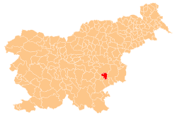
_location_map.svg.png) Gorenje Dole Location in Slovenia | |
| Coordinates: 45°56′36.26″N 15°16′56.82″E / 45.9434056°N 15.2824500°ECoordinates: 45°56′36.26″N 15°16′56.82″E / 45.9434056°N 15.2824500°E | |
| Country |
|
| Traditional region | Lower Carniola |
| Statistical region | Southeast Slovenia |
| Municipality | Škocjan |
| Area | |
| • Total | 1.16 km2 (0.45 sq mi) |
| Elevation | 256.1 m (840.2 ft) |
| Population (2002) | |
| • Total | 40 |
| [1] | |
Gorenje Dole (pronounced [ɡɔˈɾeːnjɛ ˈdoːlɛ]; German: Oberdule[2]) is a settlement in the Municipality of Škocjan in southeastern Slovenia. The area is part of the historical region of Lower Carniola. The municipality is now included in the Southeast Slovenia Statistical Region.[3]
The local church in the village is dedicated to the Holy Cross and belongs to the Parish of Škocjan. It was first mentioned in written documents dating to 1526. It was restyled in the Baroque in the 18th century.[4]
References
- ↑ Statistical Office of the Republic of Slovenia
- ↑ Leksikon občin kraljestev in dežel zastopanih v državnem zboru, vol. 6: Kranjsko. 1906. Vienna: C. Kr. Dvorna in Državna Tiskarna, p. 82.
- ↑ Škocjan municipal site
- ↑ "EŠD 2509". Registry of Immovable Cultural Heritage (in Slovenian). Ministry of Culture of the Republic of Slovenia. Retrieved 17 June 2011.
External links
| ||||||||||||||||