Gore Highway
| Gore Highway Queensland | |
|---|---|
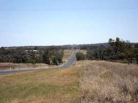 | |
| Southbrook, 2014 | |
| General information | |
| Type | Highway |
| Length | 202 km (126 mi) |
| Route number(s) |
|
| Former route number |
|
| Major junctions | |
| West end |
|
| East end |
|
| Location(s) | |
| Major settlements | Millmerran, Pittsworth |
| Highway system | |
|
Highways in Australia National Highway • Freeways in Australia Highways in Queensland | |
Gore Highway is a highway in Queensland running from Goondiwindi to Toowoomba. Together with Goulburn Valley Highway and Newell Highway, it is a part of the National Highway's Melbourne-Brisbane link. It is signed as National Highway A39.[1]
It is named after the two brothers, George & Ralph Gore. They established the huge Yandilla station in the area (between Pittsworth and Milmerran), through which the road traverses.[2]

It passes through the Queensland's Darling Downs region. Typical of the scenery are grazing cattle, orchards and grain growing fields. It was elevated to National Highway status in February 1993, and replaced the Cunningham Highway as the main route from Goondiwindi to Brisbane. Interstate traffic is rerouted through Toowoomba and the Warrego Highway as it presents a less steep gradient than via Warwick and Cunninghams Gap, making the journey faster especially for trucks. It was initially designated State Route 85 until February 1993 when National Highway 85 was proclaimed, splitting State Route 85 into two. In 2005 it was given the National Highway A39 designation.[3]
Route description
Speed Zones
- Drayton (Toowoomba) - Westbrook 90 km/h
- Westbrook - Millmerran (25 km South West) 100 km/h
- Millmerran - Goondiwindi 110 km/h
Towns and localities
- Goondiwindi
- Millmerran
- Pittsworth
- Toowoomba
Future developments
Toowoomba Second Range Crossing
The Toowoomba Second Range Crossing is a major road proposal aimed at bypassing the urban area of Toowoomba and providing a better crossing of the Great Dividing Range. The bypass will link the Warrego Highway at Helidon (in the east) with Gore Highway at Athol (southwest of Toowoomba) via Charlton and will be 41 km in length.
Major intersections
| LGA | Location | km | mi | Destinations | Notes |
|---|---|---|---|---|---|
| Goondiwindi | Goondiwindi | 0 | 0 | (A39) south - Goondiwindi | Western end of Gore Highway. Intersection is 19 km north of Goondiwindi |
| Toowoomba | Milmerran | 124 | 77 | ||
| Toowoomba | 201.4 | 125.1 | east - Toowoomba | Eastern end of Gore Highway. Intersection is 2.2 km west of Toowoomba CBD | |
| 1.000 mi = 1.609 km; 1.000 km = 0.621 mi | |||||
See also
References
- ↑ Queensland Government - Department of Transport and Main Roads - Maps
- ↑ "Gore Highway". Retrieved 23 May 2013.
- ↑ Hema, Maps (2007). Australia Road and 4WD Atlas (Map). Eight Mile Plains Queensland: Hema Maps. p. 9. ISBN 978-1-86500-456-3.
| ||||||||||||||||||||||||