Golden's Bridge, New York
| Goldens Bridge, New York | |
|---|---|
| Census-designated place | |
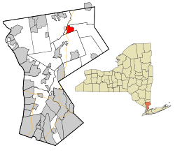 Location of Golden's Bridge, New York | |
| Coordinates: 41°17′16″N 73°40′7″W / 41.28778°N 73.66861°WCoordinates: 41°17′16″N 73°40′7″W / 41.28778°N 73.66861°W | |
| Country | United States |
| State | New York |
| County | Westchester |
| Area | |
| • Total | 2.5 sq mi (6.6 km2) |
| • Land | 2.4 sq mi (6.3 km2) |
| • Water | 0.1 sq mi (0.3 km2) |
| Elevation | 217 ft (66 m) |
| Population (2010) | |
| • Total | 1,630 |
| • Density | 670/sq mi (258.7/km2) |
| Time zone | Eastern (EST) (UTC-5) |
| • Summer (DST) | EDT (UTC-4) |
| ZIP code | 10526 |
| Area code(s) | 914 |
| FIPS code | 36-29476 |
| GNIS feature ID | 0951294 |
Golden's Bridge is a hamlet (and census-designated place) in the town of Lewisboro in Westchester County, New York. The population was 1,630 at the 2010 census.[1]
Golden's Bridge is in the western part of the town, adjacent to Interstate 684 and the Croton River.
History
Bridge L-158 was listed on the National Register of Historic Places in 1978.[2]
On February 24,2014, Goldens Bridge Firehouse was the scene of a three alarm fire. A rescue truck, 2 SUVS,and a 1943 Willys Jeep Utility/Brush Truck were damaged/destroyed.
Geography
Golden's Bridge is located at 41°17′16″N 73°40′7″W / 41.28778°N 73.66861°W (41.287896, -73.668630).[3]
According to the United States Census Bureau, the CDP has a total area of 2.5 square miles (6.6 km2), of which 2.4 square miles (6.3 km2) is land and 0.12 square miles (0.3 km2), or 5.19%, is water.[1]
Terrain
Golden's Bridge has a diverse terrain of several rocky hills, mostly with stones left from the last Ice Age. It is largely forested and includes many streams and lakes, as well as bordering the Muscoot Reservoir and the Cross River Reservoir.
Demographics
As of the census[4] of 2000, there were 1,578 people, 572 households, and 431 families residing in the CDP. The population density was 503.8 per square mile (194.7/km²). There were 607 housing units at an average density of 193.8/sq mi (74.9/km²). The racial makeup of the CDP was 95.31% White, 1.39% African American, 2.34% Asian, 0.13% from other races, and 0.82% from two or more races. Hispanic or Latino of any race were 2.28% of the population.
There were 572 households out of which 43.4% had children under the age of 18 living with them, 65.9% were married couples living together, 8.6% had a female householder with no husband present, and 24.5% were non-families. 19.1% of all households were made up of individuals and 5.8% had someone living alone who was 65 years of age or older. The average household size was 2.76 and the average family size was 3.20.
In the CDP the population was spread out with 30.5% under the age of 18, 3.4% from 18 to 24, 31.9% from 25 to 44, 25.1% from 45 to 64, and 9.0% who were 65 years of age or older. The median age was 37 years. For every 100 females there were 92.7 males. For every 100 females age 18 and over, there were 89.0 males.
The median income for a household in the CDP was $106,323, and the median income for a family was $113,460. Males had a median income of $81,072 versus $42,292 for females. The per capita income for the CDP was $52,050. About 2.5% of families and 2.4% of the population were below the poverty line [13% National average], including 3.6% of those under age 18 and 7.7% of those age 65 or over.
Education
The Katonah-Lewisboro School District serves Golden's Bridge. Increase Miller Elementary School in Golden's Bridge and John Jay Middle School and John Jay High School in Cross River serve the community.
References
- ↑ 1.0 1.1 "Geographic Identifiers: 2010 Demographic Profile Data (G001): Golden's Bridge CDP, New York". U.S. Census Bureau, American Factfinder. Retrieved January 30, 2013.
- ↑ "National Register Information System". National Register of Historic Places. National Park Service. 2009-03-13.
- ↑ "US Gazetteer files: 2010, 2000, and 1990". United States Census Bureau. 2011-02-12. Retrieved 2011-04-23.
- ↑ "American FactFinder". United States Census Bureau. Retrieved 2008-01-31.
| ||||||
| |||||||||||||||||||||||||||||||||
