Goght
Coordinates: 40°08′22″N 44°46′46″E / 40.13944°N 44.77944°E
| Goght Գողթ | |
|---|---|
|
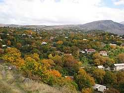
The village of Goght in October 2009 | |
 Goght Գողթ | |
| Coordinates: 40°8′22″N 44°46′46″E / 40.13944°N 44.77944°E | |
| Country |
|
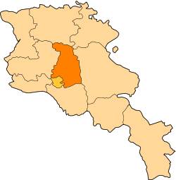
| Marz | Kotayk |
| First mentioned | 13th century |
| Government | |
| • Mayor | Artavazd Hakobyan |
| Area | |
| • Total | 12.38 km2 (4.78 sq mi) |
| Elevation | 1,600 m (5,200 ft) |
| Population (2008) | |
| • Total | 2,039 |
| Time zone | GMT +4 (UTC+4) |
Goght (Armenian: Գողթ; formerly Goghot) is a village in the Kotayk Province of Armenia, located on the right bank of Azat River. It is known from 13th-century manuscripts as Goghot. It is located near Garni and sits along the road leading to Geghard Monastery. The village has a small ruined basilica from the 17th or 18th century located straight down a dirt road from the main square. Some khachkars are built into the walls of the church. Goght sits above a large gorge and on a hill on the other side, the monastery of Havuts Tar may be seen. It may be reached by foot from the town, but more easily from Garni.
Gallery
-
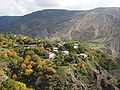
A portion of the village that sits along a ridge overlooking the gorge.
-
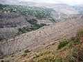
Goght as seen from Havuts Tar Monastery across the gorge.
-
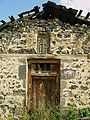
One of the doors leading into the church at Goght.
-
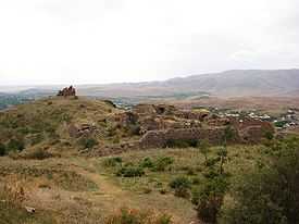
The Havuts Tar Monastic Complex located across the gorge from Goght.
References
- Kiesling, Brady (2005), Rediscovering Armenia: Guide, Yerevan, Armenia: Matit Graphic Design Studio
- Goght at GEOnet Names Server
- World Gazeteer: Armenia – World-Gazetteer.com
- Report of the results of the 2001 Armenian Census, National Statistical Service of the Republic of Armenia