Goesdorf
Goesdorf
Géisdref |
|---|
|
Commune |

Coat of arms | |

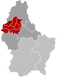
Map of Luxembourg with Goesdorf highlighted in orange, the district in dark grey, and the canton in dark red |
| Country |
 Luxembourg Luxembourg |
|---|
| District |
Diekirch |
|---|
| Canton |
Wiltz |
|---|
| Government |
|---|
| • Mayor |
Norbert Maes |
|---|
| Area |
|---|
| • Total |
29.41 km2 (11.36 sq mi) |
|---|
| Area rank |
25 of 105 |
|---|
| Highest elevation |
498 m (1,634 ft) |
|---|
| • Rank |
19th of 105 |
|---|
| Lowest elevation |
233 m (764 ft) |
|---|
| • Rank |
46th of 105 |
|---|
| Population (2014) |
|---|
| • Total |
1,404 |
|---|
| • Rank |
88th of 105 |
|---|
| • Density |
48/km2 (120/sq mi) |
|---|
| • Density rank |
90th of 105 |
|---|
| Time zone |
CET (UTC+1) |
|---|
| • Summer (DST) |
CEST (UTC+2) |
|---|
| LAU 2 |
LU00005004 |
|---|
| Website |
goesdorf.lu |
|---|
Goesdorf (Luxembourgish: Géisdref) is a commune and village in north-western Luxembourg. It is part of the canton of Wiltz, which is part of the district of Diekirch.
As of 2005, the village of Goesdorf, which lies in the south of the commune, had a population of 238. Other towns within the commune include Buderscheid, Dahl, Nocher, and Nocher-Route.
 |
Wikimedia Commons has media related to Goesdorf. |
Coordinates: 49°55′14″N 5°58′08″E / 49.92056°N 5.96889°E / 49.92056; 5.96889