Gmina Przytuły
| Gmina Przytuły Przytuły Commune | |
|---|---|
| Gmina | |
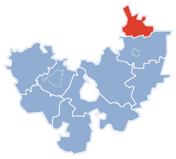 Gmina Przytuły within the Łomża County | |
| Coordinates (Przytuły): 53°22′3″N 22°18′35″E / 53.36750°N 22.30972°ECoordinates: 53°22′3″N 22°18′35″E / 53.36750°N 22.30972°E | |
| Country |
|
| Voivodeship | Podlaskie |
| County | Łomża County |
| Seat | Przytuły |
| Area | |
| • Total | 71.18 km2 (27.48 sq mi) |
| Population (2006) | |
| • Total | 2,170 |
| • Density | 30/km2 (79/sq mi) |
Gmina Przytuły is a rural gmina (administrative district) in Łomża County, Podlaskie Voivodeship, in north-eastern Poland. Its seat is the village of Przytuły, which lies approximately 27 kilometres (17 mi) north-east of Łomża and 64 km (40 mi) north-west of the regional capital Białystok.
The gmina covers an area of 71.18 square kilometres (27.5 sq mi), and as of 2006 its total population is 2,170.
Villages
Gmina Przytuły contains the villages and settlements of Bagienice, Borawskie, Chrzanowo, Doliwy, Gardoty, Grzymki, Kubra-Przebudówka, Mieczki, Mroczki, Nowa Kubra, Obrytki, Pieńki Okopne, Przytuły, Przytuły-Kolonia, Przytuły-Las, Stara Kubra, Supy, Trzaski, Wagi and Wilamowo.
Neighbouring gminas
Gmina Przytuły is bordered by the gminas of Grabowo, Jedwabne, Radziłów, Stawiski and Wąsosz.
References
| ||||||||||
| ||||||||||||||||