Gmina Kunice
Gmina Kunice
Kunice Commune |
|---|
|
Gmina |

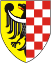
Coat of arms | |
|
Coordinates (Kunice): 51°13′27″N 16°14′52″E / 51.22417°N 16.24778°E / 51.22417; 16.24778Coordinates: 51°13′27″N 16°14′52″E / 51.22417°N 16.24778°E / 51.22417; 16.24778 |
| Country |
 Poland Poland |
|---|
| Voivodeship |
Lower Silesian |
|---|
| County |
Legnica County |
|---|
| Seat |
Kunice |
|---|
| Sołectwos |
Bieniowice, Golanka Górna, Grzybiany, Jaśkowice Legnickie, Kunice, Miłogostowice, Pątnów Legnicki, Piotrówek, Rosochata, Spalona, Szczytniki Małe, Szczytniki nad Kaczawą, Ziemnice |
|---|
| Area |
|---|
| • Total |
92.79 km2 (35.83 sq mi) |
|---|
| Population (2006) |
|---|
| • Total |
5,053 |
|---|
| • Density |
54/km2 (140/sq mi) |
|---|
| Website |
http://www.kunice.pl/ |
|---|
Gmina Kunice is a rural gmina (administrative district) in Legnica County, Lower Silesian Voivodeship, in south-western Poland. Its seat is the village of Kunice, which lies approximately 6 kilometres (4 mi) east of Legnica and 57 km (35 mi) west of the regional capital Wrocław.
The gmina covers an area of 92.79 square kilometres (35.8 sq mi), and as of 2006 its total population is 5,053.
Neighbouring gminas
Gmina Kunice is bordered by the town of Legnica and the gminas of Legnickie Pole, Lubin, Miłkowice, Prochowice and Ruja.
Villages
The gmina contains the villages of Bieniowice, Golanka Górna, Grzybiany, Jaśkowice Legnickie, Kunice, Miłogostowice, Pątnów Legnicki, Piotrówek, Rosochata, Spalona, Szczytniki Małe, Szczytniki nad Kaczawą and Ziemnice.
Sources
|
|---|
| Seat (not part of the county): Legnica | | | Urban gmina | | |
|---|
| | Urban-rural gmina | |
|---|
| | Rural gminas | |
|---|
|

