Gmina Chełmiec
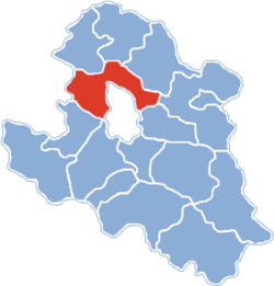
Gmina Chełmiec is a rural gmina (administrative district) in Nowy Sącz County, Lesser Poland Voivodeship, in southern Poland. Its seat is the village of Chełmiec, which lies approximately 3 kilometres (2 mi) west of Nowy Sącz and 71 km (44 mi) south-east of the regional capital Kraków.
The gmina covers an area of 112.01 square kilometres (43.2 sq mi), and as of 2006 its total population is 24,473.
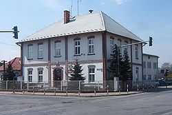
Chełmiec Commune Hall
Villages
Gmina Chełmiec contains the villages and settlements of Biczyce Dolne, Biczyce Górne, Chełmiec, Chomranice, Dąbrowa, Januszowa, Klęczany, Klimkówka, Krasne Potockie, Kunów, Kurów, Librantowa, Marcinkowice, Naściszowa, Niskowa, Paszyn, Piątkowa, Rdziostów, Świniarsko, Trzetrzewina, Ubiad, Wielogłowy, Wielopole, Wola Kurowska and Wola Marcinkowska.
Neighbouring gminas
Gmina Chełmiec is bordered by the gminas of Gródek nad Dunajcem, Grybów, Kamionka Wielka, Korzenna, Limanowa, Łososina Dolna and Podegrodzie.
References
|
|---|
| | | | Urban gmina | | |
|---|
| | Urban-rural gminas | |
|---|
| | Rural gminas | |
|---|
|