Gmina Adamów, Zamość County
| Gmina Adamów Adamów Commune | |
|---|---|
| Gmina | |
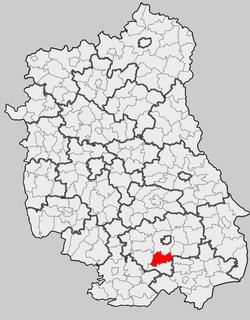 Location within the county and voivodeship | |
| Coordinates (Adamów): 50°35′43″N 23°9′12″E / 50.59528°N 23.15333°ECoordinates: 50°35′43″N 23°9′12″E / 50.59528°N 23.15333°E | |
| Country |
|
| Voivodeship | Lublin |
| County | Zamość County |
| Seat | Adamów |
| Area | |
| • Total | 110.55 km2 (42.68 sq mi) |
| Population (2006) | |
| • Total | 5,058 |
| • Density | 46/km2 (120/sq mi) |
| Website | http://www.adamow.mbnet.pl/ |
Gmina Adamów is a rural gmina (administrative district) in Zamość County, Lublin Voivodeship, in eastern Poland. Its seat is the village of Adamów, which lies approximately 16 kilometres (10 mi) south-west of Zamość and 84 km (52 mi) south-east of the regional capital Lublin.
The gmina covers an area of 110.55 square kilometres (42.7 sq mi), and as of 2006 its total population is 5,058.
Neighbouring gminas
Gmina Adamów is bordered by the gminas of Krasnobród, Krynice, Łabunie, Zamość and Zwierzyniec.
Villages
The gmina contains the following villages with the status of sołectwo: Adamów, Bliżów, Bondyrz, Boża Wola, Bródki, Czarnowoda, Feliksówka, Grabnik, Jacnia, Malinówka, Potoczek, Rachodoszcze, Suchowola, Suchowola-Kolonia, Szewnia Dolna, Szewnia Górna and Trzepieciny.
References
| ||||||||||
| |||||||||||||||||