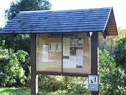
Glover-Archbold Park
|
Glover-Archbold Park | |
 | |
 | |
| Location |
Foundry Branch, NW Washington, D.C. |
|---|---|
| Coordinates | 38°55′31.32″N 77°4′55.33″W / 38.9253667°N 77.0820361°WCoordinates: 38°55′31.32″N 77°4′55.33″W / 38.9253667°N 77.0820361°W |
| Area | 221 acres (89 ha) |
| Governing body | National Park Service |
| NRHP Reference # | 06001260 [1] |
| Added to NRHP | January 16, 2007 |
Glover-Archbold Park is a stream valley park, Northwest, Washington, D.C., on the western edge of the Glover Park neighborhood. It includes Foundry Branch from Van Ness Street, to Canal Road, on the Potomac River.
History
It is named after Charles Carroll Glover and Anne Mills Archbold, who donated the land, in 1924.[2]
In 1947, Senator Carl Hayden proposed to build a four-lane divided highway called Arizona Avenue through the Glover-Archbold Park, from Canal Street in Georgetown to Wisconsin Avenue in Friendship Heights.[3] Hayden's proposed highway was not built; the path is now the Glover-Archibald Trail and the Massachusetts-39th Trail. Instead Weaver Street and Weaver Place were renamed Arizona Avenue in 1954[4] after a suggestion by the American University Park Citizens' Association.[5]
References
- ↑ "National Register Information System". National Register of Historic Places. National Park Service. 2010-07-09.
- ↑ http://biodiversity.georgetown.edu/searchfiles/infosearch.cfm?view=all&IDNumber=1520
- ↑ Rogers, Harold B. (December 21, 1947). "Hayden Bill Asks Developing Arizona Avenue: Four-lane Freeway Would Be Built from Canal Road". Washington Evening Star. p. 33.
- ↑ "Weaver Street Change to Arizona Ave. OK'd". Washington Evening Star. January 12, 1954. p. 1.
- ↑ "AU Park Unit Backs Public Works, Urges Tax Criticism Delay". Washington Evening Star. December 8, 1953. p. 33.
External links
- http://thenaturalcapital.blogspot.com/2009/08/car-free-dc-glover-archbold-park.html
- http://www.trimbleoutdoors.com/ViewTrip/39462
- http://www.dcaudubon.org/node/4480
| ||||||||||||||||||||||||||