Gloucester Road, Bristol
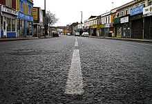
Gloucester Road, is a part of the A38 in north Bristol that runs through the suburbs of St. Andrew's, Bishopston and Horfield. It was originally called Horfield Road.
It starts at the junction with Cheltenham Road, Zetland Road and Elton Road. Cheltenham Road is spanned by a railway viaduct (known locally as "the Arches") carrying the Severn Beach Line. This is often mistakenly taken as the start of Gloucester Road, however the first property on Gloucester Road (1-3) is the Maplin electronics shop where the, now culverted, Cranbrook joins Cutler's Mills Brook. The difference between the two roads is further emphasised by the fact that Gloucester Road has the postal code of BS7 whilst Cheltenham Road is BS6.
The road continues through the outer suburbs, temporarily becoming Filton Road, then Gloucester Road North (and becoming a dual carriageway), before reverting to "Gloucester Road" shortly after passing Filton Airport and the Royal Mail Sorting Office on a flyover. Between Filton Road and Gloucester Road North it passes into South Gloucestershire.
The road bypasses Patchway and Bradley Stoke, then increases in capacity to six-lane dual carriageway as it transfers Aztec West traffic to and from the M5. It changes back to single carriageway as it passes through Almondsbury, and from there passes Alveston and Thornbury on its way to Gloucester.
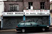
Gloucester Road also has the largest number of independent traders on any one road in the UK.
See Also
External links
Coordinates: 51°28′24″N 2°35′29″W / 51.47346°N 2.59139°W