Glendalough, Western Australia
| Glendalough Perth, Western Australia | |||||||||||||
|---|---|---|---|---|---|---|---|---|---|---|---|---|---|
 Glendalough | |||||||||||||
| Coordinates | 31°55′05″S 115°49′26″E / 31.918°S 115.824°ECoordinates: 31°55′05″S 115°49′26″E / 31.918°S 115.824°E | ||||||||||||
| Population | 2,203 (2011 census)[1] | ||||||||||||
| • Density | 3,150/km2 (8,200/sq mi) | ||||||||||||
| Postcode(s) | 6016 | ||||||||||||
| Area | 0.7 km2 (0.3 sq mi) | ||||||||||||
| LGA(s) | City of Stirling | ||||||||||||
| State electorate(s) | Churchlands | ||||||||||||
| Federal Division(s) | Curtin | ||||||||||||
| |||||||||||||
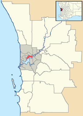
Glendalough is a suburb of Perth, Western Australia in the local government area of the City of Stirling, about 6 kilometres from Perth's central business district along the Mitchell Freeway. It was named after Glendalough in Ireland.
References
- ↑ Australian Bureau of Statistics (31 October 2012). "State Suburbs: Glendalough". 2011 Census QuickStats. Retrieved 4 July 2012.
| |||||||||||||||||||||
