Glenboig

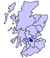
Glenboig (Scottish Gaelic: An Gleann Bhog) is a village in North Lanarkshire, Scotland lying north of Coatbridge and to the south east of Kirkintilloch. Historically the settlement formed the south eastern extremity of the ancient Gaelic province of the Lennox (Scottish Gaelic: An Leamhnachd) which lay roughly within the former county of Dunbartonshire.[1]
Glenboig's railway station closed in 1960 and the local coal mining and brick-making industries ceased by the 1980s.
The village's first school was built in 1875-6.
Glenboig's main industry was Fireclay, centred on the General Refractories and Glenboig Union Fireclay Co. Star Fireclay Works, which made refractory products for the steel and iron industries. Aerial photographs of the works are available. However another important spoke in the industrial revolution was its railways. The Monkland and Kirkintilloch Railway was started in 1824, and opened in 1826, running from Palacecraig up through Coatbridge and Gartsherrie, and immediately to the east of Glenboig village. It claims to be Scotland's first actual "railway", putting it among the first few in the world. A few years later, in 1831, the Glasgow and Garnkirk line opened, running on the other side of Glenboig, joining the Monkland and Kirkintilloch at Gartsherrie. These were the earlier Scottish lines to use locomotives. Both were built almost exclusively to carry coal but each, however, developed an increasing volume of other freight and of passenger traffic. In 1982 the Glenboig pit called Bedlay (Annathill) was closed under the Conservative government of Margaret Thatcher. Bedlay was a two shaft pit with modern enclosed headgear on one shaft and an older open type on the other. A large diameter chimney may have been for mine ventilation. Previous Owners: William Baird & Company Limited, later Bairds & Scottish Steel Limited Types of Coal: Coking, Manufacturing and House Sinking/Production Commenced: 1905 Year Closed: 1981 Year Abandoned: 1982 Average Workforce: 792 Peak Workforce: 870 Peak Year: 1959 Shaft/Mine Details: 3 shafts, No. 1 372m (NS 7205 7056), No. 2 372m (NS 7204 7058), and No. 3 362m deep (NS 7208 7049). Coal lifted in Nos.1 & 2, and men up and down No. 3. Details in 1948: Output 540 tons per day, 145,800 tons per annum. 683 employees. Campbell Binnie jig washer. No baths. Canteen, first-aid room. Electricity supplied by overhead power lines from Gartsherrie Iron Works, but 90% bought from Clyde Valley Supply. Report dated 19-08-1948. Other Details: New coal preparation plant installed by Simon Carves in 1957 as part of a £1.25 million reconstruction project completed in 1958, which included the construction of a new shaft and concrete winding tower, and the introduction of battery-locomotive underground haulage. A gassy pit with a methane drainage system, but important producer of coking coal for the iron and steel industry, particularly Ravenscraig. Latterly the coal preparation plant processed output from Auchengeich [NS67SE 28].[2]
In 1999, residents got together to discuss the problems affecting their local environment. As a result, the Glenboig and North Central Environmental Group was established with the aim of addressing local environmental issues resulting in the creation of Glenboig Village Park.
The United Kingdom Census 2001 reported the population as 1587.[3]
In recent years the village has grown, with the addition of two new housing estates. The village also has two pubs - 'The Big Shop' and 'The Village Inn' (the village inn has now closed and become derelict), a post office, beauty salon, newsagent, two take aways, and a Londis.
Within the community there are many small businesses including a coachworks, flower arrangers, architectural design service and mortgage brokers.
See also
Notes
- ↑ Newton, Michael. From Clyde To Callander.
- ↑ http://canmore.rcahms.gov.uk/en/site/128929/details/bedlay+colliery/
- ↑ "Comparative Population Profile: Glenboig Locality". SCROL. Retrieved 2009-12-07.
External links
Coordinates: 55°53′34″N 4°02′25″W / 55.8927°N 4.0403°W