Gilboa, Ohio
| Gilboa, Ohio | |
|---|---|
| Village | |
|
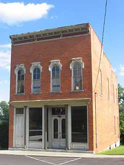
A commercial building in Gilboa's historic downtown | |
 Location of Gilboa, Ohio | |
| Coordinates: 41°1′2″N 83°55′16″W / 41.01722°N 83.92111°WCoordinates: 41°1′2″N 83°55′16″W / 41.01722°N 83.92111°W | |
| Country | United States |
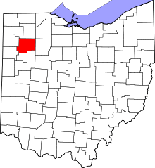
| State | Ohio |
| County | Putnam |
| Government | |
| • Type | Village Council |
| • Mayor | Richard McCullough |
| • Council President | Amber Kisseberth |
| • Clerk/Treasurer | Chrissy Durst |
| Area[1] | |
| • Total | 0.15 sq mi (0.39 km2) |
| • Land | 0.15 sq mi (0.39 km2) |
| • Water | 0 sq mi (0 km2) |
| Elevation[2] | 748 ft (228 m) |
| Population (2010)[3] | |
| • Total | 184 |
| • Estimate (2012[4]) | 182 |
| • Density | 1,226.7/sq mi (473.6/km2) |
| Time zone | Eastern (EST) (UTC-5) |
| • Summer (DST) | EDT (UTC-4) |
| ZIP code | 45875 |
| Area code(s) | 419 |
| FIPS code | 39-30114[5] |
| GNIS feature ID | 1048782[2] |
| Historical population | |||
|---|---|---|---|
| Census | Pop. | %± | |
| 1850 | 378 | — | |
| 1860 | 315 | −16.7% | |
| 1870 | 315 | 0.0% | |
| 1880 | 287 | −8.9% | |
| 1890 | 264 | −8.0% | |
| 1900 | 346 | 31.1% | |
| 1910 | 345 | −0.3% | |
| 1920 | 235 | −31.9% | |
| 1930 | 201 | −14.5% | |
| 1940 | 209 | 4.0% | |
| 1950 | 181 | −13.4% | |
| 1960 | 207 | 14.4% | |
| 1970 | 212 | 2.4% | |
| 1980 | 212 | 0.0% | |
| 1990 | 208 | −1.9% | |
| 2000 | 170 | −18.3% | |
| 2010 | 184 | 8.2% | |
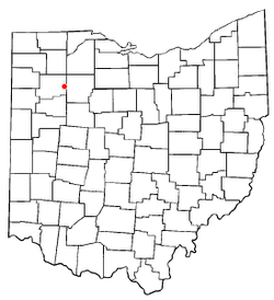
Gilboa is a village in Putnam County, Ohio, United States. The village is named after Mount Gilboa.[6] The population was 184 at the 2010 census.
Geography
Gilboa is located at 41°1′2″N 83°55′16″W / 41.01722°N 83.92111°W (41.017329, -83.921143).[7]
According to the United States Census Bureau, the village has a total area of 0.15 square miles (0.39 km2), all land.[1]
Demographics
2010 census
As of the census[3] of 2010, there were 184 people, 71 households, and 50 families residing in the village. The population density was 1,226.7 inhabitants per square mile (473.6/km2). There were 76 housing units at an average density of 506.7 per square mile (195.6/km2). The racial makeup of the village was 94.6% White, 0.5% Asian, 3.8% from other races, and 1.1% from two or more races. Hispanic or Latino of any race were 9.2% of the population.
There were 71 households of which 35.2% had children under the age of 18 living with them, 57.7% were married couples living together, 5.6% had a female householder with no husband present, 7.0% had a male householder with no wife present, and 29.6% were non-families. 28.2% of all households were made up of individuals and 12.7% had someone living alone who was 65 years of age or older. The average household size was 2.59 and the average family size was 3.18.
The median age in the village was 34 years. 25.5% of residents were under the age of 18; 8.7% were between the ages of 18 and 24; 24.4% were from 25 to 44; 22.3% were from 45 to 64; and 19% were 65 years of age or older. The gender makeup of the village was 49.5% male and 50.5% female.
2000 census
As of the census[5] of 2000, there were 170 people, 72 households, and 43 families residing in the village. The population density was 1,139.3 people per square mile (437.6/km2). There were 78 housing units at an average density of 522.8 per square mile (200.8/km2). The racial makeup of the village was 98.24% White, 0.59% from other races, and 1.18% from two or more races. Hispanic or Latino of any race were 0.59% of the population.
There were 72 households out of which 29.2% had children under the age of 18 living with them, 47.2% were married couples living together, 8.3% had a female householder with no husband present, and 38.9% were non-families. 33.3% of all households were made up of individuals and 12.5% had someone living alone who was 65 years of age or older. The average household size was 2.36 and the average family size was 3.05.
In the village the population was spread out with 26.5% under the age of 18, 4.1% from 18 to 24, 34.1% from 25 to 44, 20.6% from 45 to 64, and 14.7% who were 65 years of age or older. The median age was 36 years. For every 100 females there were 112.5 males. For every 100 females age 18 and over, there were 104.9 males.
The median income for a household in the village was $29,844, and the median income for a family was $31,250. Males had a median income of $29,286 versus $22,045 for females. The per capita income for the village was $15,535. None of the families and 5.2% of the population were living below the poverty line, including no under eighteens and 11.5% of those over 64.
School
Pandora-Gilboa is the school district many students from Gilboa attend, although some attend Ottawa-Glandorf.
Historical information
- 1833 - 1st known Methodist Church in Putnam County is founded in what later became Gilboa. Charter Members are Mr & Mrs Samuel Hall, Mr & Mrs Moses Williams, Sarah Crawfis, Louisa Guisinger, G. W. Montgomery, and Samuel McDonald.
- 1837 - Town laid out by Elisha Stout
- 1837 - 1st house built by Nelson McCallister
- 1839 - 1st general store opened by Edward Mercer
- 1839 - 1st bar opened by Benjamin Stewart
- 1839 - 1848 Gilboa had the fastest growth rate of any town in Putnam County.
- 1841 - Gilboa residents, through Representative Patrick G. Good, petitioned Congress to establish a postal route passing through Gilboa from Findlay to Francona[8]
- 1843 - 1st Post Office
- 1848 - February 18, Gilboa is incorporated as a municipality by the 46th Ohio Congress[9]
- 1850 - Census shows population at 378. Other area populations were: Columbus Grove 118, Kalida 216, Ottawa 104, Lima 757.
March 1, The Findlay, Gilboa, and Defiance Plank Road Company is incorporated by the Ohio General Assembly[10] to create a road from Findlay in Hancock County to Gilboa. Sec. 9 of the Act gave detailed instructions, stating that the road had to go to the most western road in Gilboa and then go north along that road before going to the town of Medary in Putnam County. The act also specified "Defiance Street" in Gilboa as a reference point (I have been unable to locate a Defiance Street on any of the old maps).
March 3, The Gilead And Gilboa Plank Road Company is incorporated by the Ohio General Assembly[2] to create a road from the bank of the Maumee River near Gilead in Wood County to Gilboa. to make the road they had to get Federal approval for the right of way to cross Federal land.[11] The initial stock was valued at $50,000.
- 1851 - March 1 a meeting is held in Gilboa to organize a committee to bring a railroad to Putnam County by raising $75,000 in public funds via a tax. The tax was passed on Oct. 12 1852 with 955 for and 391 against. On July 4, 1859 the first train passed through Putnam County.
- 1852 - Cholera epidemic kills 13 Gilboa residents[12]
- 1870 - Census shows population at 315. Other area populations were: Belmore 261, Columbus Grove 578, Kalida 290, Leipsic 200.
- 1870 - Odd Fellows Lodge 459 is established in Gilboa
Patent 103,892 is granted to Jacob Kauffman of Gilboa for a sewing machine design.[13]
- 1874 - A.D. McClure's 250' wide Plank Dam, damming the Blanchard River for his sawmill & grist mill is referenced in an engineering book on mill dam construction. A drawing of the dam is included.[14]
The McClure & Mathias Pharmacy/Druggist business was in existence, within a few years it was sold by the owner and became Harmans & Son. [15]
- 1875 - Odd Fellows Lodge is burned down with all records
- 1876 - Odd Fellows Lodge reestablished
- 1888 - Gilboa finally gets railroad access. Nicknamed the Tangent Line, it was originally built by the New York, Mahoning and Western Railroad (became American Midland Railroad in 1889, Findlay, Ft Wayne & Western Railroad in 1890, Cincinnati, Hamilton and Dayton Railroad in 1901, Cincinnati, Findlay, & Fort Wayne Railroad in 1903)
- 1898 - Bowe & Goodall buy out Pharmacist H.F. Truman of Toledo and move the business to Gilboa.[16]
- 1909- Patent 932103 is granted to E.F. Black of Gilboa for a snare curette, a device to remove genito-uninary warts[10]
- 1912-1924 Baltimore & Ohio purchased the rail line servicing Gilboa in 1912 and shut it down sometime between 1917 & 1924 (Railroad records say by 1919 but a 1922 map shows the railroad while a 1924 ODOT map does not).
- 1913 - The Gilboa Farmers Mutual Telephone Company is referenced in that year's Public Utilities Commission Report.[17] The number of subscribers is 190. It is also mentioned in the 1914 report.[18]
- 1979 Gilboa Main St listed as a historic district.
Cholera epidemic
On August 6, 1852 a Cholera epidemic struck Gilboa. The start of the epidemic was traced to a large damp celler that had been used to store trash and decomposing waste.[19] The epidemic lasted until the August 21st and killed 13 Gilboa residents[12] including one of the two doctors that had not fled. Out of the estimated 600 population, all but 40 fled including 4 of the 6 Gilboa doctors. Once the Cholera ran its course, the population suffered from Typhoid Fever and diarrhea for the remainder of the year.
Mayors
- 1909 - D R Oren[20] Term Exp. 1910
Police chiefs/village marshals
- 1909 - Frank Wood[20]
Gilboa post masters
- 1851 - Lyman W Moe[16]
- 1855 - John E Creighton[21]
- 1857 - Jerome Youngkin[22]
- 1859 - Jerome Youngkin[23]
Notable natives
- Edward S. Matthias was an Ohio Supreme Court justice from 1914 until his death in 1953. Having served 38 years, he was the longest serving justice of the court.
- Dr Charles H. Spencer D.O. was one of the pioneers of modern Osteopathic medicine.[20][24]
Gilboa related/referencing literary works
- Fatal Depth: Deep Sea Diving, China Fever, and the wreck of the Andrea Doria Author Joseph Haberstroh - Although the author states that the Gilboa Quarry his character trains at is near Cincinnati he describes driving on Old State Route 224 and passing Gilboa's giant fiberglass bull.[25]
References
- ↑ 1.0 1.1 "US Gazetteer files 2010". United States Census Bureau. Retrieved 2013-01-06.
- ↑ 2.0 2.1 2.2 "US Board on Geographic Names". United States Geological Survey. 2007-10-25. Retrieved 2008-01-31.
- ↑ 3.0 3.1 "American FactFinder". United States Census Bureau. Retrieved 2013-01-06.
- ↑ "Population Estimates". United States Census Bureau. Retrieved 2013-06-17.
- ↑ 5.0 5.1 "American FactFinder". United States Census Bureau. Retrieved 2008-01-31.
- ↑ Gannett, Henry (1905). The Origin of Certain Place Names in the United States. Govt. Print. Off. p. 137.
- ↑ "US Gazetteer files: 2010, 2000, and 1990". United States Census Bureau. 2011-02-12. Retrieved 2011-04-23.
- ↑ Journal of the House of Representatives of the United States, May 31, 1841 to September 13, 1841 SATURDAY, June 12, 1841, pg. 116, retrieved 2011-09-14.
- ↑ Acts of a General Nature passed by the Forty-Sixth General Assembly of the State of Ohio , pg. 167, retrieved 2011-09-15.
- ↑ 10.0 10.1 Acts of a Local Nature Passed by the Forty Eighth General Assembly of The State of Ohio, pg. 43, retrieved 2011-09-14.
- ↑ Journal of the House of Representatives of the United States, 1849-1850 WEDNESDAY, March 13, 1850, pg. 668, retrieved 2011-09-14.
- ↑ 12.0 12.1 The Cholera Epidemic of 1873 in The United States, pg. 634, retrieved 2011-09-15.
- ↑ Third Session, Forty First Congress Executive Documents 1870-71, pg. 129, retrieved 2011-09-14.
- ↑ The Construction of Mill Dams J. Leffel & Co, pg. 162, retrieved 2011-09-14.
- ↑ Portrait & Biographical Album of Isabella County, Michigan 1884, pg. 430-431, retrieved 2011-09-15.
- ↑ 16.0 16.1 The Pharmaceutical Era Volumn 20, pg. 31, retrieved 2011-09-15.
- ↑ Report of The Public Utilities Commission of Ohio To the Governor for the Year 1913, pg. 854, retrieved 2011-09-14.
- ↑ Report of The Public Utilities Commission of Ohio To the Governor for the Year 1914, pg. 854, retrieved 2011-09-14.
- ↑ Transactions of the American Medical Association Volume 7, pg. 349, retrieved 2011-09-15.
- ↑ 20.0 20.1 20.2 Ohio Township & Municipal Officers 1909, pg. 410, retrieved 2011-09-14.
- ↑ List of Post Offices in The United States on the 1st of July, 1855, pg. 61, retrieved 2011-09-14.
- ↑ List of Post Offices in The United States on the 13th of July, 1857, pg. 56, retrieved 2011-09-14.
- ↑ List of The Post Offices of The United States on the 1st of April, 1859, pg. 61, retrieved 2011-09-14.
- ↑ Los Angeles From the Mountains to the Sea, pg. 627, retrieved 2011-09-15.
- ↑ Fatal Depth, pg. 186-187, retrieved 2011-09-15.
External links
- Gilboa Police Department
- Gilboa Main St Historic District
- Gilboa Quarry - A popular deep diving location
- Hillside Winery - Probably the most popular business in Gilboa.
- The Big Bull - a popular Gilboa attraction.
- Stinky's Country Well - sign for the local bar on US 224
| |||||||||||||||||||||||||