Gila Bend, Arizona
| Gila Bend, Arizona | ||
|---|---|---|
| Town | ||
|
A humorous, numerically outdated sign welcomes people to Gila Bend, Arizona. | ||
| ||
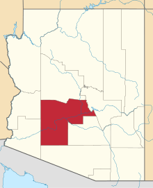
 Location in Maricopa County and the state of Arizona | ||
| Coordinates: 32°57′0″N 112°43′29″W / 32.95000°N 112.72472°WCoordinates: 32°57′0″N 112°43′29″W / 32.95000°N 112.72472°W | ||
| Country | United States | |
| State | Arizona | |
| County | Maricopa | |
| Founded | 1872 | |
| Incorporated | 1962 | |
| Government | ||
| • Mayor | Ron Henry | |
| Area | ||
| • Total | 22.8 sq mi (59.1 km2) | |
| • Land | 22.8 sq mi (59.1 km2) | |
| • Water | 0.0 sq mi (0.0 km2) | |
| Elevation | 735 ft (224 m) | |
| Population (2010)[1] | ||
| • Total | 1,922 | |
| • Estimate (2013[2]) | 1,977 | |
| • Density | 90.1/sq mi (34.8/km2) | |
| Time zone | MST (no DST) (UTC-7) | |
| ZIP code | 85337 | |
| Area code(s) | 928 | |
| FIPS code | 04-27050 | |
| Website | http://www.gilabendaz.org/ | |


Gila Bend (/ˌhiːlə ˈbɛnd/; O'odham: Hila Wi:n), founded in 1872, is a town in Maricopa County, Arizona, United States. The town is named for an approximately 90-degree bend in the Gila River, which is close to but not precisely at the community's current location.[3] According to the 2010 census, the population of the town is 1,922.[1]
Just outside the town is the San Lucy district (O'odham: Weco Cekṣanĭ) of the Tohono O'odham Nation, with a tiny settlement, San Lucy (O'odham: Si:l Mek) bordering the town itself.
On December 14, 2006, Volkswagen of America, Inc., leased 11,900 acres (48 km2) of land at a cost of $55 million for 25 years, ten miles (16 km) west of Gila Bend, on which they plan to develop a new automobile proving ground.[4] Gila Bend enjoys a minor notability among tourists and aficionados of roadside attractions. Besides the quirky welcome sign (shown at right), the town boasts several roadside sculptures[5] and the Space Age Lodge motel and restaurant (opened in 1963), named for its "Space Age" themed architecture and decor.[6][7]
The band Los Lobos wrote a song called "The Road To Gila Bend", which appears on their 2006 release The Town and the City.
Geography
Gila Bend is located at 32°57′0″N 112°43′29″W / 32.95000°N 112.72472°W (32.950027, -112.724701).[8] The town is just off Interstate 8 on Arizona State Route 85, which provides access between I-8 and Interstate 10 north of Gila Bend. In recognition of historical routes that pass through the area, the town's website refers to Gila Bend as "The Crossroads of the Southwest".[9] According to the United States Census Bureau, the town has a total area of 22.8 square miles (59 km2), all of it land.
Climate
| Climate data for Gila Bend, Arizona | |||||||||||||
|---|---|---|---|---|---|---|---|---|---|---|---|---|---|
| Month | Jan | Feb | Mar | Apr | May | Jun | Jul | Aug | Sep | Oct | Nov | Dec | Year |
| Average high °F (°C) | 69 (21) |
74 (23) |
80 (27) |
88 (31) |
97 (36) |
106 (41) |
109 (43) |
107 (42) |
103 (39) |
91 (33) |
78 (26) |
69 (21) |
89.3 (31.9) |
| Average low °F (°C) | 41 (5) |
44 (7) |
48 (9) |
54 (12) |
62 (17) |
71 (22) |
79 (26) |
79 (26) |
72 (22) |
59 (15) |
47 (8) |
41 (5) |
58.1 (14.5) |
| Average precipitation inches (mm) | 0.62 (15.7) |
0.87 (22.1) |
0.72 (18.3) |
0.20 (5.1) |
0.15 (3.8) |
0.04 (1) |
0.76 (19.3) |
1.20 (30.5) |
0.53 (13.5) |
0.52 (13.2) |
0.56 (14.2) |
0.84 (21.3) |
7.01 (178) |
| Source: Weather.com / NWS | |||||||||||||
Gila Bend has an arid desert climate, characterized by extremely hot summers and warm winters. The average annual rainfall is approximately 7 inches (177.8 mm).
During the winter months, daytime highs average about 65 °F to 75 °F (18 °C to 24 °C). As typical with the desert in relatively undeveloped areas, there is nothing to keep the heat continuing after the sun sets, so temperatures rapidly drop after sunset. Sometimes this swing can be larger than 30 degrees. This means that average wintertime night lows are about 40 °F to 50 °F (4 °C to 10 °C), with an occasional night lower than 40 °F (4 °C). The all time lowest recorded temperature in Gila Bend was 10 °F (-12 °C), which occurred on January 13, 1963.
Gila Bend has extremely hot summers with highest temperatures recorded for the state of Arizona, and temperatures at or exceeding 110 °F (41 °C) are the norm for the entirety of summer as well as the beginning of September. Even the month of May experiences some days above 100 °F (38 °C). It should also be noted that with an average July high of 109 °F (43 °C), temperatures exceeding 115 °F (46 °C) are common for the area, especially for that particular month. Lows during the summer are generally in the upper 70s and low 80s. The all time highest recorded temperature in Gila Bend is 122 °F (50 °C), which occurred on June 26, 1990 and again on July 28, 1995.
Demographics
| Historical population | |||
|---|---|---|---|
| Census | Pop. | %± | |
| 1910 | 199 | — | |
| 1920 | 745 | 274.4% | |
| 1930 | 1,275 | 71.1% | |
| 1960 | 1,813 | — | |
| 1970 | 1,795 | −1.0% | |
| 1980 | 1,585 | −11.7% | |
| 1990 | 1,747 | 10.2% | |
| 2000 | 1,980 | 13.3% | |
| 2010 | 1,922 | −2.9% | |
| Est. 2013 | 1,977 | 2.9% | |
| U.S. Decennial Census[10] 2013 Estimate[2] | |||
As of the census of 2000, there were 1,980 people, 659 households, and 492 families residing in the town. The population density was 86.7 people per square mile (33.5/km²). There were 766 housing units at an average density of 33.5 per square mile (13.0/km²). The racial makeup of the town was 51.31% White, 1.31% Black or African American, 10.25% Native American, 0.35% Asian, 32.42% from other races, and 4.34% from two or more races. 52.63% of the population were Hispanic or Latino of any race.
There were 659 households out of which 42.8% had children under the age of 18 living with them, 52.7% were married couples living together, 14.3% had a female householder with no husband present, and 25.3% were non-families. 22.2% of all households were made up of individuals and 8.6% had someone living alone who was 65 years of age or older. The average household size was 3.00 and the average family size was 3.51.
In the town the population was spread out with 32.9% under the age of 18, 11.6% from 18 to 24, 27.0% from 25 to 44, 20.1% from 45 to 64, and 8.4% who were 65 years of age or older. The median age was 29 years. For every 100 females there were 105.4 males. For every 100 females age 18 and over, there were 107.8 males.
The median income for a household in the town was $26,895, and the median income for a family was $30,403. Males had a median income of $25,284 versus $20,588 for females. The per capita income for the town was $10,793. About 22.2% of families and 24.8% of the population were below the poverty line, including 29.3% of those under age 18 and 23.8% of those age 65 or over.
Historical events
The town of Gila Bend is situated near an ancient Hohokam village. When Father Eusebio Francisco Kino visited in 1699, the older site along fertile banks of the Gila River had been abandoned and other tribes, lived in the vicinity. 132 Pima people lived in a rancheria called Oyadaibuc or as Kino named it San Felipe y Santiago del Oyadaibuc, near the modern town, and other Pima lived in three rancherias up river to the north mixed with the Cocomaricopa or Opa. Kino's expedition counted 960 Opas living in their own rancherias down river to the west of Oyadaibuc as far as a few miles beyond Agua Caliente.[11] The Pima used the flood waters of the river to irrigate their crops. Oyadaibuc was also visited by Juan Bautista de Anza, commander of the Presidio at Tubac and founder of the city of San Francisco, and by Father Francisco Tomas Garces in 1774.[9]
From 1857, Gila Ranch was a stagecoach stop on the San Antonio-San Diego Mail Line and the later more famous Butterfield Overland Mail route to California located 17 miles from Murderer's Grave Station to the west and 40 miles east of Maricopa Wells Station. Later other stage and freight routes and the railroad converged here. The nickname the "Crossroads of the Southwest" stems from the area having been part of an important transportation route in the settling, development and growth of the Great Southwest. Gila Bend was the "center of a wheel", with spokes leading in many directions throughout the region.[9]
A more recent event in the area was the October 1995 sabotage of the Amtrak Sunset Limited train.[12]
In 2010 Abengoa Solar secured a $1.45 BUSD loan guarantee to build a large 280 megawatt Concentrated Solar Power Plant in Gila Bend. It is estimated that the project will employ a peak of 1,500 workers with an operational permanent employment of approximately 85 workers. The Solana Generating Station is scheduled to start providing power for Arizona Public Service in 2013.[13]
References
- ↑ 1.0 1.1 "American FactFinder". United States Census Bureau. Retrieved 2014-07-10.
- ↑ 2.0 2.1 "Population Estimates". United States Census Bureau. Retrieved 2014-07-10.
- ↑ Barnes,, Will. "History and Information About Gila Bend, Arizona". reprinted from Arizona's names: X marks the place. Falconer Publishing / Treasure Chest Publications. Retrieved 2006-12-06.
- ↑ "State Land Department Announces Auction Success With Volkswagen Of America, Inc.". State Land Department News & Information. Arizona State Land Department. 2006-12-15. Retrieved 2007-01-24.
- ↑ "Gila Bend, Arizona". Roadside America. Retrieved 2006-12-06.
- ↑ "Best Western Space Age Lodge and Restaurant". Retrieved 2009-02-10.
- ↑ "Gila Bend". Around AZ. Retrieved 2006-12-06.
- ↑ "US Gazetteer files: 2010, 2000, and 1990". United States Census Bureau. 2011-02-12. Retrieved 2011-04-23.
- ↑ 9.0 9.1 9.2 "Town of Gila Bend - The Crossroads of the Southwest". Town of Gila Bend web site. Town of Gila Bend. Retrieved 2006-12-06.
- ↑ United States Census Bureau. "Census of Population and Housing". Retrieved July 10, 2014.
- ↑ John P. Wilson, Peoples of the Middle Gila: A Documentary History of the Pimas and Maricopas, 1500's - 1945, Researched and Written for the Gila River Indian Community, Sacaton, Arizona, 1999, pp.26-27
- ↑ "At least one dead, 100-plus injured in Amtrak derailment". CNN.com. Cable News Network, Inc. Retrieved 2006-12-06.
- ↑ Smith, Rebecca (2010-12-30). "Solar Plant to Generate Power After Sundown" (WEBPAGE). online.wsj.com. Wall Street Journal, Inc. Retrieved 2011-01-05.
External links
- Official website
- http://www.time.com/time/magazine/article/0,9171,907001,00.htm Death at Gila Bend
| |||||||||||||||||||||||||||||||||||||
| ||||||||||||||||||||||||||||||
| ||||||