Gideon, Missouri
| Gideon, Missouri | |
|---|---|
| City | |
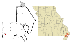 Location of Gideon, Missouri | |
| Coordinates: 36°27′17″N 89°55′7″W / 36.45472°N 89.91861°WCoordinates: 36°27′17″N 89°55′7″W / 36.45472°N 89.91861°W | |
| Country | United States |
| State | Missouri |
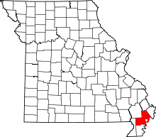
| County | New Madrid |
| Area[1] | |
| • Total | 1.80 sq mi (4.66 km2) |
| • Land | 1.79 sq mi (4.64 km2) |
| • Water | 0.01 sq mi (0.03 km2) |
| Elevation | 269 ft (82 m) |
| Population (2010)[2] | |
| • Total | 1,093 |
| • Estimate (2012[3]) | 1,058 |
| • Density | 610.6/sq mi (235.8/km2) |
| Time zone | Central (CST) (UTC-6) |
| • Summer (DST) | CDT (UTC-5) |
| ZIP code | 63848 |
| Area code(s) | 573 |
| FIPS code | 29-26974[4] |
| GNIS feature ID | 0718432[5] |
Gideon is a city in New Madrid County, Missouri, United States. The population was 1,093 at the 2010 census.
History
The first hotel was built in Gideon in 1900, the first store was opened in 1901, the first doctor's office and first school were opened in 1903, and the first post office was opened in 1904.
From 1931 to 1986, Gideon was the home of the Gideon Box Plant, which employed as many as 250 people. It produced more beverage cases than any other factory in the United States. These boxes were shipped to every state in the United States, Cuba, and Central and South America. During World War II the box factory, under government contract, manufactured tent pins and ammunition boxes. The factory was the only factory in the U.S. engaged in the making of tent pins.
Geography
Gideon is located at 36°27′17″N 89°55′7″W / 36.45472°N 89.91861°W (36.454799, -89.918691).[6]
According to the United States Census Bureau, the city has a total area of 1.80 square miles (4.66 km2), of which, 1.79 square miles (4.64 km2) is land and 0.01 square miles (0.03 km2) is water.[1]
Demographics
| Historical population | |||
|---|---|---|---|
| Census | Pop. | %± | |
| 1910 | 702 | — | |
| 1920 | 1,197 | 70.5% | |
| 1930 | 1,315 | 9.9% | |
| 1940 | 1,606 | 22.1% | |
| 1950 | 1,754 | 9.2% | |
| 1960 | 1,411 | −19.6% | |
| 1970 | 1,112 | −21.2% | |
| 1980 | 1,240 | 11.5% | |
| 1990 | 1,104 | −11.0% | |
| 2000 | 1,113 | 0.8% | |
| 2010 | 1,093 | −1.8% | |
| source:[7] | |||
2010 census
As of the census[2] of 2010, there were 1,093 people, 418 households, and 281 families residing in the city. The population density was 610.6 inhabitants per square mile (235.8/km2). There were 458 housing units at an average density of 255.9 per square mile (98.8/km2). The racial makeup of the city was 99.36% White, 0.09% Black or African American, and 0.55% from two or more races. Hispanic or Latino of any race were 0.27% of the population.
There were 418 households of which 34.9% had children under the age of 18 living with them, 48.1% were married couples living together, 14.8% had a female householder with no husband present, 4.3% had a male householder with no wife present, and 32.8% were non-families. 29.4% of all households were made up of individuals and 14.1% had someone living alone who was 65 years of age or older. The average household size was 2.47 and the average family size was 3.03.
The median age in the city was 39.1 years. 25.6% of residents were under the age of 18; 7.6% were between the ages of 18 and 24; 23.1% were from 25 to 44; 24.2% were from 45 to 64; and 19.4% were 65 years of age or older. The gender makeup of the city was 47.8% male and 52.2% female.
2000 census
As of the census[4] of 2000, there were 1,113 people, 430 households, and 288 families residing in the city. The population density was 618.6 people per square mile (238.7/km²). There were 465 housing units at an average density of 258.4 per square mile (99.7/km²). The racial makeup of the city was 98.56% White, 0.09% Native American, 0.72% from other races, and 0.63% from two or more races. Hispanic or Latino of any race were 0.99% of the population.
There were 430 households out of which 35.6% had children under the age of 18 living with them, 50.9% were married couples living together, 12.6% had a female householder with no husband present, and 32.8% were non-families. 29.8% of all households were made up of individuals and 17.7% had someone living alone who was 65 years of age or older. The average household size was 2.44 and the average family size was 3.03.
In the city the population was spread out with 26.7% under the age of 18, 8.6% from 18 to 24, 25.1% from 25 to 44, 20.0% from 45 to 64, and 19.6% who were 65 years of age or older. The median age was 38 years. For every 100 females there were 85.5 males. For every 100 females age 18 and over, there were 81.3 males.
The median income for a household in the city was $22,208, and the median income for a family was $31,094. Males had a median income of $26,406 versus $19,821 for females. The per capita income for the city was $13,556. About 21.5% of families and 25.5% of the population were below the poverty line, including 30.6% of those under age 18 and 27.1% of those age 65 or over.
Schools
Gideon has a public school system which has two school facilities, Gideon Elementary and Gideon High School. The bulldog is the mascot for the Gideon schools.
Notable people from Gideon
- Jack Campbell lived in Gideon. He was a gospel song writer and musician, having his song "I Know A Man Who Can" performed by George Jones. Campbell died on February 12, 2007 at his home in Gideon, at the age of 79.
- Scott Crockett, born in Sikeston, attended school in Gideon. Scott is an animator who has worked on cartoons, like Kappa Mikey, which appears on Nickelodeon. He has also worked on Ellen's Acres and Furby Island.
Trivia
The novel Sins of the Flesh by Don and Jay Davis begins in Gideon, Missouri.
References
- ↑ 1.0 1.1 "US Gazetteer files 2010". United States Census Bureau. Retrieved 2012-07-08.
- ↑ 2.0 2.1 "American FactFinder". United States Census Bureau. Retrieved 2012-07-08.
- ↑ "Population Estimates". United States Census Bureau. Retrieved 2013-05-30.
- ↑ 4.0 4.1 "American FactFinder". United States Census Bureau. Retrieved 2008-01-31.
- ↑ "US Board on Geographic Names". United States Geological Survey. 2007-10-25. Retrieved 2008-01-31.
- ↑ "US Gazetteer files: 2010, 2000, and 1990". United States Census Bureau. 2011-02-12. Retrieved 2011-04-23.
- ↑ "Missouri Population 1900 - 1990" (CSV). Missouri Census Data Center. Retrieved 6 October 2014.
External links
- Gideon Online
- More of Gideon's history
- Criminal Minds official website
- Mandy Patinkin official website
| |||||||||||||||||||||||||