Giaginsky District
| Giaginsky District Гиагинский район (Russian) Джэджэ район (Adyghe) | |
|---|---|
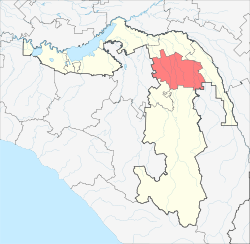 Location of Giaginsky District in the Republic of Adygea | |
| Coordinates: 44°53′N 40°03′E / 44.883°N 40.050°ECoordinates: 44°53′N 40°03′E / 44.883°N 40.050°E | |
 | |
|
| |
| Location | |
| Country | Russia |
| Federal subject | Republic of Adygea[1] |
| Administrative structure (as of June 2012) | |
| Administrative center | stanitsa of Giaginskaya[1] |
| Inhabited localities: | |
| Rural localities | 30 |
| Municipal structure (as of October 2004) | |
| Municipally incorporated as | Giaginsky Municipal District[2] |
| Municipal divisions:[2] | |
| Urban settlements | 0 |
| Rural settlements | 5 |
| Local government: | |
| Head of Administration[3] | Anatoly Cherkov[3] |
| Representative body | Council of People's Deputies |
| Statistics | |
| Area | 790 km2 (310 sq mi)[4] |
| Population (2010 Census) | 31,766 inhabitants[5] |
| - Urban | 0% |
| - Rural | 100% |
| Density | 40.21/km2 (104.1/sq mi)[6] |
| Time zone | MSK (UTC+03:00)[7] |
| Established | December 31, 1934[8] |
| Official website | |
| Giaginsky District on WikiCommons | |
Giaginsky District (Russian: Гиаги́нский райо́н; Adyghe: Джэджэ район) is an administrative[1] and a municipal[2] district (raion), one of the seven in the Republic of Adygea, Russia. It is located in the northern central portion of the republic and borders with Shovgenovsky District in the north, Koshekhablsky District in the east and northeast, Mostovsky District of Krasnodar Krai in the southeast, Maykopsky District in the south, and with Belorechensky District of Krasnodar Krai in the west. The area of the district is 790 square kilometers (310 sq mi).[4] Its administrative center is the rural locality (a stanitsa) of Giaginskaya.[1] District's population: 31,766 (2010 Census);[5] 33,458 (2002 Census);[9] 32,060 (1989 Census).[10] The population of Giaginskaya accounts for 44.5% of the district's total population.[5]
History
Giaginsky District was established within Azov-Black Sea Krai on December 31, 1934[8] as a result of the downsizing of that krai's districts. On April 10, 1936, Khansky Selsoviet of Maykopsky District of the krai was merged into Giaginsky District and the latter, along with the city of Maykop, was transferred to Adyghe Autonomous Oblast.[8] On February 1, 1963, Maykopsky District of Adyghe Autonomous Oblast was merged into Giaginsky District to create Giaginsky Rural District (Гиа́гинский се́льский райо́н).[8] However, as the new system of rural districts did not prove to be efficient, Giaginsky District was re-instated in its pre-1963 borders on January 12, 1965.[8]
Divisions
Administrative divisions
Giaginsky District has administrative jurisdiction over all of its thirty rural localities.
Municipal divisions
Municipally, the district is divided into five rural settlements:[2]
| Rural settlements | Rural localities in jurisdiction* |
|---|---|
| Ayryumovskoye (Айрюмовское) |
|
| Dondukovskoye (Дондуковское) |
|
| Giaginskoye (Гиагинское) |
|
| Kelermesskoye (Келермесское) |
|
| Sergiyevskoye (Сергиевское) |
|
*Administrative centers are shown in bold
References
Notes
- ↑ 1.0 1.1 1.2 1.3 Law #171
- ↑ 2.0 2.1 2.2 2.3 Law #249
- ↑ 3.0 3.1 Official website of the Republic of Adygea. Information about Giaginsky District (Russian)
- ↑ 4.0 4.1 Official website of Giaginsky District (Russian)
- ↑ 5.0 5.1 5.2 Russian Federal State Statistics Service (2011). "Всероссийская перепись населения 2010 года. Том 1" [2010 All-Russian Population Census, vol. 1]. Всероссийская перепись населения 2010 года (2010 All-Russia Population Census) (in Russian). Federal State Statistics Service. Retrieved June 29, 2012.
- ↑ The value of density was calculated automatically by dividing the 2010 Census population by the area specified in the infobox. Please note that this value may not be accurate as the area specified in the infobox does not necessarily correspond to the area of the entity proper or is reported for the same year as the population.
- ↑ Правительство Российской Федерации. Федеральный закон №107-ФЗ от 3 июня 2011 г. «Об исчислении времени», в ред. Федерального закона №248-ФЗ от 21 июля 2014 г. «О внесении изменений в Федеральный закон "Об исчислении времени"». Вступил в силу по истечении шестидесяти дней после дня официального опубликования (6 августа 2011 г.). Опубликован: "Российская газета", №120, 6 июня 2011 г. (Government of the Russian Federation. Federal Law #107-FZ of June 31, 2011 On Calculating Time, as amended by the Federal Law #248-FZ of July 21, 2014 On Amending Federal Law "On Calculating Time". Effective as of after sixty days following the day of the official publication.).
- ↑ 8.0 8.1 8.2 8.3 8.4 Азаренкова, А. С.; И. Ю. Бондарь, Н. С. Вертышева (1986) [1986]. Основные административно-территориальные преобразования на Кубани (1793–1985 гг.) (in Russian). Краснодарское книжное издательство. p. 97, 180.
- ↑ Russian Federal State Statistics Service (May 21, 2004). "Численность населения России, субъектов Российской Федерации в составе федеральных округов, районов, городских поселений, сельских населённых пунктов – районных центров и сельских населённых пунктов с населением 3 тысячи и более человек" [Population of Russia, Its Federal Districts, Federal Subjects, Districts, Urban Localities, Rural Localities—Administrative Centers, and Rural Localities with Population of Over 3,000] (XLS). Всероссийская перепись населения 2002 года [All-Russia Population Census of 2002] (in Russian). Retrieved August 9, 2014.
- ↑ Demoscope Weekly (1989). "Всесоюзная перепись населения 1989 г. Численность наличного населения союзных и автономных республик, автономных областей и округов, краёв, областей, районов, городских поселений и сёл-райцентров" [All Union Population Census of 1989: Present Population of Union and Autonomous Republics, Autonomous Oblasts and Okrugs, Krais, Oblasts, Districts, Urban Settlements, and Villages Serving as District Administrative Centers]. Всесоюзная перепись населения 1989 года[All-Union Population Census of 1989] (in Russian). Институт демографии Национального исследовательского университета: Высшая школа экономики [Institute of Demography at the National Research University: Higher School of Economics]. Retrieved August 9, 2014.
Sources
- Государственный Совет — Хасэ Республики Адыгея. Закон №171 от 5 мая 2000 г. «Об административно-территориальном устройстве Республики Адыгея», в ред. Закона №97 от 6 июня 2012 г. «О внесении изменений в некоторые Законы Республики Адыгея в связи с принятием Закона Республики Адыгея "Об отнесении посёлка городского типа Тульского к категории посёлков — сельских населённых пунктов"». Вступил в силу со дня официального опубликования. Опубликован: "Советская Адыгея", №156-157, 7 августа 2004 г. (State Assembly of the Republic of Adygea. Law #171 of May 5, 2000 On the Administrative-Territorial Structure of the Republic of Adygea, as amended by the Law #97 of June 6, 2012 On Amending Various Laws of the Republic of Adygea Due to the Adoption of the Law of the Republic of Adygea "On Transformation of the Urban-Type Settlement of Tulsky into a Settlement—a Rural Locality. Effective as of the official publication date.).
- Совет Республики Адыгея. Закон №249 от 22 октября 2004 г. «О наделении муниципального образования "Гиагинский район" статусом муниципального района, об образовании муниципальных образований в его составе и установлении их границ», в ред. Закона №363 от 18 декабря 2014 г. «О внесении изменений в Закон Республики Адыгея "О наделении муниципального образования "Гиагинский район" статусом муниципального района, об образовании муниципальных образований в его составе и установлении их границ"». Вступил в силу со дня официального опубликования. Опубликован: "Советская Адыгея", №208–210, 2 ноября 2004 г. (Council of the Republic of Adygea. Law #249 of October 22, 2004 On Granting Municipal District Status to the Municipal Formation of "Giaginsky District", on Establishing Municipal Formations Within Its Structure, and on Establishing Their Borders, as amended by the Law #363 of December 18, 2014 On Amending the Law of the Republic of Adygea "On Granting Municipal District Status to the Municipal Formation of "Giaginsky District", on Establishing Municipal Formations Within Its Structure, and on Establishing Their Borders". Effective as of the day of the official publication.).
External links
- Official website of Giaginsky District (Russian)
- Official website of the Republic of Adygea. Information about Giaginsky District (Russian)
| ||||||||||||||||||||||||