Ghod Dam
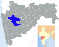
Ghod Dam, is an earthfill dam on Ghod River near Shirpur, Ahmednagar district in State of Maharashtra in India.
Specifications
Ghod dam is situated near shirur, Pune district. The height of the dam above lowest foundation is 29.6 m (97 ft) while the length is 3,300 m (10,800 ft). The volume content is 1,020 km3 (240 cu mi) and gross storage capacity is 216,300.00 km3 (51,893.13 cu mi).[2]
Purpose
See also
References
|
|---|
| | History | | |
|---|
| | Geography | |
|---|
| | Talukas | |
|---|
| | Cities and towns | |
|---|
| | Monuments | |
|---|
| | Education | |
|---|
| | Lok Sabha constituencies | |
|---|
| | Vidhan Sabha constituencies | |
|---|
| | Dams in District | |
|---|
|