Germi County
| Germi County شهرستان گرمی | |
|---|---|
| County | |
| Coordinates: 39°00′N 47°57′E / 39.000°N 47.950°ECoordinates: 39°00′N 47°57′E / 39.000°N 47.950°E | |
| Country |
|
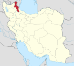
| Province | Ardabil Province |
| Capital | Germi |
| Bakhsh (Districts) | Central District, Anguti District, Muran District |
| Population (2006) | |
| • Total | 89,248 |
| Time zone | IRST (UTC+3:30) |
| • Summer (DST) | IRDT (UTC+4:30) |
| Germi County at GEOnet Names Server | |
Germi County (Persian: شهرستان گرمی) is a county in Ardabil Province in Iran.It placed in north of Ardabil city. The capital of the county is Germi. At the 2006 census, the county's population was 89,248, in 18,710 families.[1] The county is divided into three districts: Anguti District, the Central District, and Muran District. The county has two cities: Germi and Tazeh Kand-e Anguti.
The history of the county reaches back to 1734. Germi is located 120 km (75 mi) from Ardabil, the capital of the province. The yearly precipitation is 300 mm (11.8 in) and a temperature of −10 to 36 °C (14 to 97 °F) allows farmers to reach good yealds in growing cereals. Germi is reletaively new by Iranian standards; established in the year 900 of the Islamic calendar when Shah Ismaieal allowed 5 shiat families migrate to this region. There were some other places and cities in Azerbaijan of I.R. Iran and Azerbaijan that are called Germi.
The most historical place in this county is Barzand Castle that was the castle of Afshin who battled with Babak Khorramdin in earlier century of Islamic history.People of this county are Muslim and speak in Azeri. The largest river of country is Dareroud; it issues from southern and eastern foot of Sabalan and joins to Aras river on the northern border of I.R.Iran. This river is the largest internal river of Ardabil province.
References
- ↑ "Census of the Islamic Republic of Iran, 1385 (2006)". Islamic Republic of Iran. Archived from the original (EXCEL) on 2011-11-11.
- اطلس گیتاشناسی استانهای ایران [Atlas Gitashenasi Ostanhai Iran] (Gitashenasi Province Atlas of Iran)
External links
| Wikimedia Commons has media related to Germi county. |
| ||||||||||||||||||||||||||||||||||||||||||||||||||||||||||