German Township, Bartholomew County, Indiana
| German Township | |
|---|---|
| Township | |
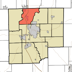 Location in Bartholomew County | |
| Coordinates: 39°18′10″N 85°59′20″W / 39.30278°N 85.98889°WCoordinates: 39°18′10″N 85°59′20″W / 39.30278°N 85.98889°W | |
| Country | United States |
| State | Indiana |
| County | Bartholomew |
| Government | |
| • Type | Indiana township |
| Area | |
| • Total | 31.33 sq mi (81.1 km2) |
| • Land | 31.23 sq mi (80.9 km2) |
| • Water | 0.1 sq mi (0.3 km2) 0.32% |
| Elevation | 646 ft (197 m) |
| Population (2010) | |
| • Total | 7,093 |
| • Density | 227.1/sq mi (87.7/km2) |
| ZIP codes | 46124, 47201, 47203, 47280 |
| GNIS feature ID | 0453325 |
German Township is one of twelve townships in Bartholomew County, Indiana, United States. As of the 2010 census, its population was 7,093 and it contained 2,920 housing units.[1]
Geography
According to the 2010 census, the township has a total area of 31.33 square miles (81.1 km2), of which 31.23 square miles (80.9 km2) (or 99.68%) is land and 0.1 square miles (0.26 km2) (or 0.32%) is water.[1] Camp Atterbury borders the township to the west.
Cities, towns, villages
- Columbus (north edge)
- Edinburgh (south quarter)
- Taylorsville
Unincorporated towns
- North Gate
- North Park
- Pleasant View Village
(This list is based on USGS data and may include former settlements.)
Adjacent townships
- Jackson Township, Shelby County (northeast)
- Washington Township, Shelby County (northeast)
- Flat Rock Township (east)
- Columbus Township (south)
- Blue River Township, Johnson County (northwest)
Cemeteries
The township contains these three cemeteries: Steenbarger, Tannehill and Treadway.
Major highways
-
 Interstate 65
 -
 U.S. Route 31
School districts
- Bartholomew County School Corporation
Political districts
- Indiana's 6th congressional district
- State House District 59
- State Senate District 41
References
- United States Census Bureau 2007 TIGER/Line Shapefiles
- United States Board on Geographic Names (GNIS)
- United States National Atlas
- ↑ 1.0 1.1 "Population, Housing Units, Area, and Density: 2010 - County -- County Subdivision and Place -- 2010 Census Summary File 1". United States Census. Retrieved 2013-05-10.
External links
| |||||||||||||||||||||||||||||||||