Georgia State Route 335
| ||||
|---|---|---|---|---|
| Danielsville Street | ||||
 | ||||
| Route information | ||||
| Maintained by GDOT | ||||
| Length: | 8.4 mi[1] (13.5 km) | |||
| Existed: | June 1, 1963[2][3] – present | |||
| Major junctions | ||||
| West end: |
| |||
| East end: |
| |||
| Location | ||||
| Counties: | Jackson | |||
| Highway system | ||||
| ||||

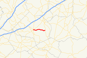
State Route 335 (SR 335) is a 8.4-mile-long (13.5 km) east-to-west state highway located entirely within Jackson County in the northeastern part of the U.S. state of Georgia. It connects Jefferson to Nicholson.
Route description
SR 335 begins at an intersection with SR 15 Alt./SR 82 (Sycamore Street) in Jefferson. The highway travels to the east, through rural portions of Jackson County until it meets its eastern terminus, an intersection with US 441/SR 15 (Main Street) in Nicholson. Here, the roadway continues as Mulberry Street.[1]
SR 335 is not part of the National Highway System, a system of roadways important to the nation's economy, defense, and mobility.[4]
History
The roadway that would eventually be designated as SR 335 was built in the late 1950s along its current alignment.[5][6] By 1963, this road was designated, and paved, as SR 335.[2][3]
Major intersections
The entire route is in Jackson County.
| Location | mi[1] | km | Destinations | Notes | |
|---|---|---|---|---|---|
| Jefferson | 0.00 | 0.00 | Western terminus | ||
| Nicholson | 8.39 | 13.50 | Eastern terminus of SR 335; western terminus of Mulberry Street | ||
| 1.000 mi = 1.609 km; 1.000 km = 0.621 mi | |||||
See also
- Georgia (U.S. state) portal
- U.S. Roads portal
References
- ↑ 1.0 1.1 1.2 Google (June 9, 2014). "Route of SR 335" (Map). Google Maps. Google. Retrieved June 9, 2014.
- ↑ 2.0 2.1 http://www.dot.ga.gov/informationcenter/maps/Documents/StateMaps/1961.pdf
|mapurl=missing title (help) (Map) (PDF). State Highway System and Other Principal Connecting Roads (PDF). Cartography by GSHD. State Highway Department of Georgia. June 1, 1960. Retrieved June 9, 2014. - ↑ 3.0 3.1 http://www.dot.ga.gov/informationcenter/maps/Documents/StateMaps/1963.pdf
|mapurl=missing title (help) (Map) (PDF). State Highway System and Other Principal Connecting Roads (PDF). Cartography by GSHD. State Highway Department of Georgia. June 1, 1963. Retrieved June 9, 2014. - ↑ National Highway System: (Draft) Georgia (PDF) (Map). Federal Highway Administration. November 15, 2013. Retrieved June 9, 2014.
- ↑ http://www.dot.ga.gov/informationcenter/maps/Documents/StateMaps/1955.pdf
|mapurl=missing title (help) (Map) (PDF). State Highway System and Other Principal Connecting Roads (PDF). Cartography by GSHD. State Highway Department of Georgia. June 1, 1955. Retrieved June 9, 2014. - ↑ http://www.dot.ga.gov/informationcenter/maps/Documents/StateMaps/1957.pdf
|mapurl=missing title (help) (Map) (PDF). State Highway System and Other Principal Connecting Roads (PDF). Cartography by GSHD. State Highway Department of Georgia. July 1, 1957. Retrieved June 9, 2014.
External links
Route map: Bing
-
 Media related to Georgia State Route 335 at Wikimedia Commons