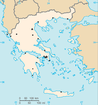
Geography of Greece
Greece is a country located in Southern Europe, its mainland located at the southern end of the Balkan Peninsula. Greece is surrounded on the north by Bulgaria, the Republic of Macedonia and Albania; to the west by the Ionian Sea; to the south by the Mediterranean Sea and to the east by the Aegean Sea and Turkey. The country ranges in latitude from 35°00′N to 42°00′N and in longitude from 19°00′E to 28°30′E. As a result, it has considerable climatic variation, as discussed below. The country consists of a large mainland; the Peloponnese, a peninsula connected to the southern tip of the mainland by the Isthmus of Corinth; and a large number of islands, including Crete, Rhodes, Corfu, the Dodecanese and the Cyclades. According to the CIA World Factbook, Greece has 13,676 kilometres (8,498 mi) of coastline.[1]
Climate
Greece's climate is divided into three main classes:
- A Mediterranean climate features mild, wet winters and hot, dry summers. Temperatures rarely reach extremes, although snowfalls do occur occasionally even in Athens, Cyclades or Crete during the winter.
- An alpine climate is found primarily in Western Greece (Epirus, Central Greece, Thessaly, Western Macedonia as well as central parts of the Peloponnese such as Achaea, Arkadia and parts of Lakonia).
- A temperate climate is found in Central and Eastern Macedonia and parts of Thrace, including Komotini, Xanthi and northern Evros. This climate is characterized by cold, damp winters and hot, dry summers.
Physical geography
Greece is located in Southern Europe, bordering the Ionian Sea and the Mediterranean Sea, between Albania and Turkey. It is a peninsular country, possessing an archipelago of about 3,000 islands.
It has a total area of 131,957 km2 (50,949 sq mi),[2] of which land area is 130,647 km2 and internal waters (lakes and rivers) account for 1,310 km2. Land boundaries with Albania (212 km), Republic of Macedonia (234 km), Bulgaria (472 km) and Turkey (192 km) measure approximately 1,110 km in total.
Greece's coastline measures 13,676 km (8,498 mi).
80% of Greece is mountainous, and it is one of the most mountainous countries of Europe. The Pindus mountain range lies across the center of the country in a northwest-to-southeast direction, with a maximum elevation of 2,637 m. Extensions of the same mountain range stretch across the Peloponnese and underwater across the Aegean, forming many of the Aegean Islands including Crete, and joining with the Taurus Mountains of southern Turkey. Central and western Greece contain high and steep peaks intersected by many canyons and other karstic landscapes, including the Meteora and the Vikos Gorges - the latter being one of the largest of the world and the third deepest after the Copper Canyon in Mexico and the Grand Canyon in the United States, plunging vertically for more than 1,100 metres.
Mount Olympus is the highest point in Greece and the fourth highest in relative topographical prominence in Europe, rising to 2,919 m above sea level. The Rhodope Mountains form the border between Greece and Bulgaria; that area is covered with vast and thick forests.
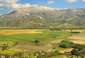
Plains are also found in eastern Thessaly, in central Macedonia and in Thrace. Western Greece contains lakes and wetlands.
The extreme points of Greece are [3]
- North: Ormenio village (41°45′41″ N, 26°13′15″ E)
- South: Gavdos island (34°48′11″ N, 24°07′25″ E)
- East: Strongyli island (36°06′17″ N, 29°38′39″ E)
- West: Othonoi island (39°51′11″ N, 19°22′41″ E)
|
Sporades
Islands
North Aegean
Islands
 |
| Regions of Greece |

| Cities and islands of Greece |

Mainland
Mainland Greece forms the southernmost part of the Balkan peninsula. The north of the country includes parts of the historical regions of Macedonia and Thrace (Western Thrace). To the south it narrows into a separate peninsula in its own right, which includes the regions of Epirus, Thessaly, and Central Greece. The latter includes the region of Attica where lies the capital of Greece, Athens, and the large offshore island of Euboea. Further south, the Peloponnese peninsula is separated from the rest of the Greek mainland by the Corinthian Gulf and the Isthmus of Corinth.
The major mountain range of Greece is the Pindus range, the southern extension of the Dinaric Alps, which forms the spine of the Greek mainland, separating Epirus from Thessaly and Macedonia. The country's highest mountain is Mount Olympus, which separates Thessaly from Macedonia. Its highest peak rises to 2,919 m above sea level, making it the second highest of the Balkan peninsula after Musala in the Rila Mountains.
Islands
Greece has a very large number of islands and islets, most of them in the Aegean Sea. Estimates of the number of islands vary between 1,200 and 6,000.[4] A figure frequently cited in travel guides is 1,425 islands, of which 166 are said to be inhabited.[5] The Greek Tourism Organization reports a figure of 6,000, with 227 of them inhabited.[6]
Crete
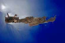
Crete is the biggest island of Greece and the second largest, after Cyprus, in the Eastern Mediterranean. The island spans 260 km from east to west and 60 km at its widest. The island narrows in the region close to Ierapetra, where it is only 12 km wide. Crete covers an area of 8,336 km2 (3,219 sq mi), with a coastline of 1046 km. It is surrounded to the north by the Sea of Crete; to the south by the Libyan Sea; to the west by the Myrtoan Sea; and to the east by the Karpathion Sea. It lies approximately 160 km south of the Greek mainland.
Crete is characterized by a mountain range crossing from west to east, formed by three different subranges:
- The White Mountains or Lefka Ori (2,452 m);
- The Idi Range (Psiloritis (35°11′N 24°49′E / 35.18°N 24.82°E) 2,456 m);
- The Dikti Mountains (2,148 m)
These encompass fertile plateaus, such as Lasithi, Omalos and Nidha; caves such as Diktaion and Idaion; and gorges such as the Samariá Gorge. The protected area of the Samariá Gorge is the home of the Cretan goat, or kri-kri, while the endangered Bearded vulture or lammergeyer libes in the Cretan mountains and gorges.
Crete's rivers include the Ieropotamos River on the southern part of the island.
Climate
Crete straddles two climatic zones, the Mediterranean and the North African, mainly falling within the former. As such, the climate in Crete is primarily temperate. The atmosphere can be quite humid, depending on the proximity to the sea, while winter is fairly mild. Snowfall is common on the mountains between November and May, but rare in low-lying areas, especially near the coast. During the summer, average temperatures may reach the low 30s °C, with maxima touching the mid 40s.
The south coast, including the Mesara Plain and Asterousia Mountains, falls in the North African climatic zone, and thus reaches higher temperatures throughout the year. In southern Crete, date palms bear fruit and swallows remain all year round, without migrating to Africa.
Ionian Islands
The Ionian Islands are a group of seven islands. The six northern islands lie off the western coast of Greece, in the Ionian Sea. The other island, Kythira, lies off the southern tip of the Peloponnese. Kythira is part of the modern region of Attica and is therefore not regarded as part of the modern region of the Ionian Islands (Ionioi Nisoi). The Ionian Islands are distinct from the historical region of Ionia, which is today part of western Turkey.
Aegean
The islands of the Aegean Sea are situated between mainland Greece to the west and north, Anatolia to the east and the island of Crete to the south. Traditionally, the islands are classified into seven groups, from north to south:
- North Aegean Islands
- Sporades
- Euboea
- Saronic Islands
- Cyclades
- Dodecanese (Southern Sporades)
- Crete and the Ionian Islands
Land use
- Arable land: 19.71%
- Permanent crops: 8.95%
- Other: 71.37% (2012 est.)
Irrigated land: 15,550 km2 (2007)
Environment
Greece's natural hazards include severe earthquakes, droughts and wildfires. Current environmental issues include air pollution and water pollution.
Greece is party to the following international agreements:
Air Pollution, Air Pollution-Nitrogen Oxides, Air Pollution-Sulphur 94, Antarctic-Environmental Protocol, Antarctic Treaty, Biodiversity, Climate Change, Desertification, Endangered Species, Environmental Modification, Hazardous Wastes, Law of the Sea, Marine Dumping, Nuclear Test Ban, Ozone Layer Protection, Ship Pollution, Tropical Timber 83, Tropical Timber 97, Wetlands
-
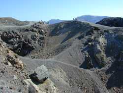
Volcanic crater, Santorini
-

Mount Pelion
-

Potidea Kanal, Chalkidiki
-
Manganari beach, Ios (island)
-
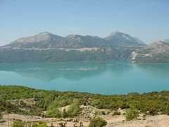
Landscape of Stymfalia with Mount Kyllini
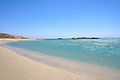
-
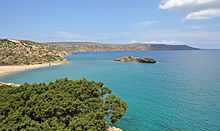
Palm beach of Vai (Crete)


See also
- Greek islands
- List of earthquakes in Greece
- Greek names of mountains
- National parks in Greece
- Geography of Europe
References
- ↑ "The World Fact Book - Field Listing :: Coastline". CIA. Retrieved 2011-03-17.
- ↑ CIA World Fact Book,
- ↑ "Statistical Yearbook of Greece 2009 & 2010" (PDF). Hellenic Statistical Authority. p. 27.
- ↑ Marker, Sherry; Kerasiotis, Peter (2010). "Greece in depth". In Nadeau, Mark. Frommer's Greece. Hoboken: Wiley. p. 12.
- ↑ Poffley, Frewin (2002). Greek Island Hopping. Thomas Cook. p. 15.
- ↑ Ellinikos Organismos Tourismou (EOT). "Greek islands". Retrieved 29 April 2012.
| ||||||||||||||||||
| |||||||||||||||||||||||||||||||||||||||||||||||
