Gayaza-Ziroobwe Road
Gayaza-Ziroobwe Road is a road in central Uganda, connecting the towns of Gayaza in Wakiso District and Ziroobwe in Luweero District.
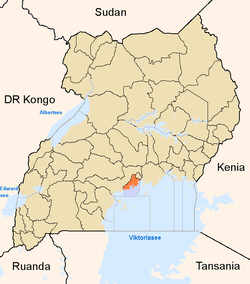
Location
The Gayaza-Ziroobwe Road starts at Gayaza and goes through Namulonge, Busiika, Bugema and ends in Ziroobwe, a distance of 33 kilometres (21 mi).[1] The coordinates of the road near Bugema University in Luweero District are:0°34'14.0"N, 32°38'38.0"E (Latitude:0.570556; Longitude:32.643889).[2]
Overview
Prior to 2007, the road had a gravel surface. In 2008, the Uganda Government began to upgrade the road from gravel to bitumen at an estimated cost of US$40 million. The work, undertaken by a Serbian firm, Energoprojekt, commenced in March 2007 and was originally expected to be completed in November 2009.[3] The construction and improvement of the road has been extended to include the Kampala-Gayaza section of the road. Due to repeated delays, completion did not occur until June 2011.[4]
Points of interest
The following points of interest lie along or near the Gayaza-Ziroobwe Road:
- The town of Gayaza in Wakiso District, 3 kilometres (1.9 mi), by road, east of Kasangati
- Gayaza High School - A prestigious all girls boarding high school established in 1905.
- Kabanyolo Farm - An agricultural and livestock farm that belongs to the College of Agricultural Sciences and College of Veterinary Medicine, at Makerere University.
- The town of Namulonge in Wakiso District
- The National Crops Resources Research Institute - Located at Namulonge.
- The main campus of Bugema University at Bugema in Luweero District
- The town of Busiika in Luweero District
- The town of Ziroobwe in Luweero District
See also
References
- ↑ "Road Distance Between Gayaza And Ziroobwe With Map". Globefeed.com. Retrieved 9 February 2015.
- ↑ Google, . "Location of Gayaza-Ziroobwe Road At Google Maps". Google Maps.
- ↑ Baguma, Raymond (25 November 2008). "Gayaza Road Gets Tarmac". New Vision (Uganda). Retrieved 9 February 2015.
- ↑ Mena Report, . (14 July 2011). "Uganda : Conclusion of Gayaza-Zirobwe Road Construction". Highbeam.com. Retrieved 9 February 2015.
External links
Coordinates: 00°34′14″N 32°38′38″E / 0.57056°N 32.64389°E
| ||||||||||||||||||||||||||||