Gaya, Nigeria
| Gaya | |
|---|---|
 Gaya | |
| Coordinates: 11°52′5″N 9°0′40″E / 11.86806°N 9.01111°ECoordinates: 11°52′5″N 9°0′40″E / 11.86806°N 9.01111°E | |
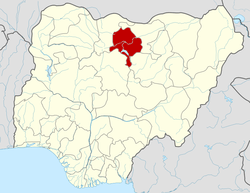
| State | Kano State |
| Area | |
| • Total | 613 km2 (237 sq mi) |
| Elevation | 415 m (1,364 ft) |
| Population (2006 Census) | |
| • Total | 201,016 |
| Time zone | West Africa Time (UTC+1) |
| • Summer (DST) | West Africa Time (UTC+1) |
| 3-digit postal code prefix | 713 |
| ISO 3166 code | NG.KN.GY |
Gaya is a Local Government Area in Kano State, Nigeria. Its headquarters are in the town of Gaya in the north of the area.
It has an area of 613 km² and a population of 201,016 at the 2006 census.
The postal code of the area is 713.[1]
History
Gaya is believed to be the origin of a man named Kano who first settled in the present Kano State on his search for ironstone. Gaya served as an important terminus of a migratory corridor through which there was an influx of immigrating peoples especially from Eastern Sudan, the Maghrib and the Middle East.
Traditional state
The traditional ruler of Gaya is known as the Sarkin Gaya. The present Sarkin Gaya, Alhaji Ibrahim Abdulkadir Gaya (born 1 January 1931) has been on the throne since his appointment in 1990. Alhaji Ibrahim Gaya was previously the district head of Kunchi and then Minjibir.
References
- ↑ "Post Offices- with map of LGA". NIPOST. Retrieved 2009-10-20.
- Gaya, Nigeria Page. Falling Rain Genomics, Inc. 1996-2004. Retrieved 2009-03-25.