Gaurnadi Upazila
| Gaurnadi গৌরনদী | |
|---|---|
| Upazila | |
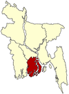
 Gaurnadi Location in Bangladesh | |
| Coordinates: 22°58.4′N 90°13.8′E / 22.9733°N 90.2300°ECoordinates: 22°58.4′N 90°13.8′E / 22.9733°N 90.2300°E | |
| Country |
|
| Division | Barisal Division |
| District | Barisal District |
| Area | |
| • Total | 144.18 km2 (55.67 sq mi) |
| Population (2001) | |
| • Total | 180,219 |
| • Density | 1,250/km2 (3,200/sq mi) |
| Time zone | BST (UTC+6) |
| Website | Official website of the Gaurnadi Upazila |
Gaurnadi (Bengali: গৌরনদী) is an Upazila of Barisal District in the Division of Barisal, Bangladesh.[1]
Geography
Gaurnadi is located at 22°58′25″N 90°13′50″E / 22.9736°N 90.2306°E. It has 37,047 households and a total area of 144.18 km².
Demographics
According to the 2001 Bangladesh census, Gaurnadi had a population of 180,219. Males constituted 51.03% of the population, and females 48.97%. Gaurnadi had an average literacy rate of 59.4% (7+ years).[2]
Administration
Gaurnadi has one town (Gaurnadi) and 7 unions. The unions are further subdivided into 128 mouzas containing 130 villages. The unions are:
- Khanjapur
- Barthi
- Chandshi
- Mahilara
- Nalchira
- Batajore
- Sarikal
See also
References
- ↑ Md Mizanur Rahman (2012). "Gaurnadi Upazila". In Sirajul Islam and Ahmed A. Jamal. Banglapedia: National Encyclopedia of Bangladesh (Second ed.). Asiatic Society of Bangladesh.
- ↑ "Census Results by Upazila/Thana" (PDF). Bangladesh Bureau of Statistics. 2001. Retrieved 2008-08-27.
External links
| |||||||||||||||||||||||||||||||||