Garnat-sur-Engièvre
| Garnat-sur-Engièvre | |
|---|---|
|
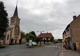
The main road in Garnat-sur-Engièvre | |
 Garnat-sur-Engièvre | |
|
Location within Auvergne region  Garnat-sur-Engièvre | |
| Coordinates: 46°38′04″N 3°39′49″E / 46.6344°N 3.6636°ECoordinates: 46°38′04″N 3°39′49″E / 46.6344°N 3.6636°E | |
| Country | France |
| Region | Auvergne |
| Department | Allier |
| Arrondissement | Moulins |
| Canton | Chevagnes |
| Intercommunality | Pays de Chevagnes en Sologne Bourbonnaise |
| Government | |
| • Mayor (2008–2014) | Joël Maitre |
| Area1 | 18.74 km2 (7.24 sq mi) |
| Population (2008)2 | 727 |
| • Density | 39/km2 (100/sq mi) |
| INSEE/Postal code | 03120 / 03230 |
| Elevation |
202–242 m (663–794 ft) (avg. 200 m or 660 ft) |
|
1 French Land Register data, which excludes lakes, ponds, glaciers > 1 km² (0.386 sq mi or 247 acres) and river estuaries. 2 Population without double counting: residents of multiple communes (e.g., students and military personnel) only counted once. | |
Garnat-sur-Engièvre is a commune in the Allier department in central France.
Population
| Historical population | ||
|---|---|---|
| Year | Pop. | ±% |
| 1962 | 696 | — |
| 1968 | 786 | +12.9% |
| 1975 | 762 | −3.1% |
| 1982 | 722 | −5.2% |
| 1990 | 715 | −1.0% |
| 1999 | 734 | +2.7% |
| 2008 | 727 | −1.0% |
See also
References
| Wikimedia Commons has media related to Garnat-sur-Engièvre. |