Garfield Township, Clay County, Iowa
| Garfield Township | |
|---|---|
| Township | |
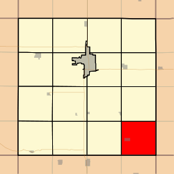 Location in Clay County | |
| Coordinates: 42°56′46″N 094°59′00″W / 42.94611°N 94.98333°WCoordinates: 42°56′46″N 094°59′00″W / 42.94611°N 94.98333°W | |
| Country |
|
| State |
|
| County | Clay |
| Area | |
| • Total | 35.98 sq mi (93.2 km2) |
| • Land | 35.96 sq mi (93.14 km2) |
| • Water | 0.02 sq mi (0.06 km2) 0.06% |
| Elevation | 1,411 ft (430 m) |
| Population (2000) | |
| • Total | 311 |
| • Density | 8.6/sq mi (3.3/km2) |
| GNIS feature ID | 0467891 |
Garfield Township is a township in Clay County, Iowa, USA. As of the 2000 census, its population was 311.
Geography
Garfield Township covers an area of 35.98 square miles (93.2 km2) and contains one incorporated settlement, Webb. According to the USGS, it contains one cemetery, Garfield Township.
Mud Lake is within this township.
References
External links
| |||||||||||||||||