Ganjingzi District
| Ganjingzi 甘井子区 | |||||||||||||||||||||||||||||||
|---|---|---|---|---|---|---|---|---|---|---|---|---|---|---|---|---|---|---|---|---|---|---|---|---|---|---|---|---|---|---|---|
| District | |||||||||||||||||||||||||||||||
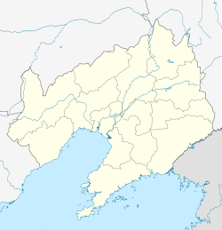 Ganjingzi Location in Liaoning | |||||||||||||||||||||||||||||||
| Coordinates: 38°57′17″N 121°33′30″E / 38.9546°N 121.5584°ECoordinates: 38°57′17″N 121°33′30″E / 38.9546°N 121.5584°E[1] | |||||||||||||||||||||||||||||||
| Country |
| ||||||||||||||||||||||||||||||
| Province | Liaoning | ||||||||||||||||||||||||||||||
| Sub-provincial city | Dalian | ||||||||||||||||||||||||||||||
| Area[2] | |||||||||||||||||||||||||||||||
| • Total | 451.52 km2 (174.33 sq mi) | ||||||||||||||||||||||||||||||
| Population (2010)[3] | |||||||||||||||||||||||||||||||
| • Total | 1,321,778 | ||||||||||||||||||||||||||||||
| • Density | 2,900/km2 (7,600/sq mi) | ||||||||||||||||||||||||||||||
| Time zone | China Standard (UTC+8) | ||||||||||||||||||||||||||||||
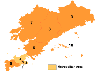
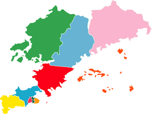
| Dalian district map | |||||||||||||||||||||||||||||||
| |||||||||||||||||||||||||||||||
| Website |
dlgjz | ||||||||||||||||||||||||||||||
Ganjingzi District (simplified Chinese: 甘井子区; traditional Chinese: 甘井子區; pinyin: Gānjǐngzǐ Qū) is one of six districts of Dalian, Liaoning province, People's Republic of China, forming part of the urban core. Its area is 451.52 square kilometres (174.33 sq mi) and its permanent population as of 2010 is 1,321,778 (making it Dalian's most populous county-level division)[2][3] and postal code 116033.
Administrative divisions
There are 14 subdistricts in the district.[4]
Subdistricts:
- Yingchengzi Subdistrict (营城子街道), Gezhenpu Subdistrict (革镇堡街道), Ganjingzi Subdistrict (甘井子街道), Jiaojinshan Subdistrict (椒金山街道), Zhoushuizi Subdistrict (周水子街道), Zhonghua Road Subdistrict (中华路街道), Paoya Subdistrict (泡崖街道), Airport Subdistrict (机场街道), Xinghua Subdistrict (兴华街道), Nanguanling Subdistrict (南关岭街道), Quanshui Subdistrict (泉水街道), Xinzhaizi Subdistrict (辛寨子街道), Hongqi Subdistrict (红旗街道), Dalian Bay Subdistrict (大连湾街道)
References
External links
| ||||||||||||||||||||||||||||||||||||||||||||||||||||||||||||||||||||||
| |||||||||||||||||||||||||||||||||||||