Gamnangtar
| Gamnangtar गाम्नाङटार | |
|---|---|
| Village development committee | |
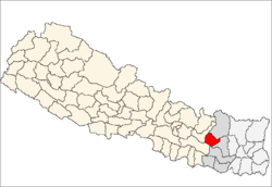
 Gamnangtar Location in Nepal | |
| Coordinates: 27°23′N 86°16′E / 27.39°N 86.26°ECoordinates: 27°23′N 86°16′E / 27.39°N 86.26°E | |
| Country |
|
| Zone | Sagarmatha Zone |
| District | Okhaldhunga District |
| Population (1991) | |
| • Total | 2,925 |
| Time zone | Nepal Time (UTC+5:45) |
| Postal code | 56107 |
| Area code(s) | 037 |
Gamnangtar is a village development committee in Okhaldhunga District in the Sagarmatha Zone of mid-eastern Nepal. At the time of the 1991 Nepal census it had a population of 2925 living in 535 individual households.[1]
References
- ↑ "Nepal Census 2001", Nepal's Village Development Committees (Digital Himalaya), retrieved 15 November 2009.
ns