Gajarkot
| Gajarkot गाजरकोट | |
|---|---|
| Village development committee | |
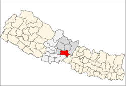
 Gajarkot Location in Nepal | |
| Coordinates: 27°53′N 83°59′E / 27.88°N 83.98°ECoordinates: 27°53′N 83°59′E / 27.88°N 83.98°E | |
| Country |
|
| Zone | Gandaki Zone |
| District | Tanahu District |
| Population (1991) | |
| • Total | 5,385 |
| Time zone | Nepal Time (UTC+5:45) |
Gajarkot is a village development committee in Tanahu District in the Gandaki Zone of central Nepal. At the time of the 1991 Nepal census it had a population of 5385 people living in 983 individual households.It contains 9 ward. Ward no. Kathekot-1, Katahare-2,Dumkot-3, Puttar - 4&5, Attrauli-6, Baindi-7,Gajarkot-8 and Dumribesi- 9.[1]
References
- ↑ "Nepal Census 2001", Nepal's Village Development Committees (Digital Himalaya), retrieved 15 November 2009.