Gabès Governorate
| Gabès ڨابس Qabis | ||
|---|---|---|
| Governorate | ||
| ||
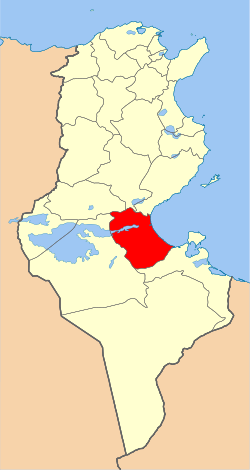 Map of Tunisia with Gabès highlighted | ||
| Coordinates: 33°53′N 10°07′E / 33.883°N 10.117°ECoordinates: 33°53′N 10°07′E / 33.883°N 10.117°E | ||
| Country | Tunisia | |
| Created | June 21, 1981 | |
| Capital | Gabès | |
| Government | ||
| • Governor | Abdelkarim Mesbah (DCR) | |
| Area | ||
| • Total | 7,175 km2 (2,770 sq mi) | |
| Area rank | Ranked 7th of 24 | |
| Population (2014) | ||
| • Total | 374,300 | |
| • Rank | Ranked 16th of 24 | |
| • Density | 52/km2 (140/sq mi) | |
| Demonym |
Gabesian (Arabic: قابسي, Gabsi) | |
| Time zone | CET (UTC+01) | |
| Postal prefix | 60xx | |
| Calling code | 75-2/75-3 | |
| ISO 3166 code | TN-81 | |
Gabès Governorate (Arabic: ولاية ڨابس Wilāyat Gābis) is one of the 24 governorates of Tunisia. It is located in south-eastern Tunisia. It covers an area of 7,175 square kilometres (2,770 sq mi) and has a population of 374,300 (2014 census).[1] The capital is Gabès.
Geography
The governorate of Gabès is located in southeast Tunisia on the coast of the Gulf of Gabès, 376 km south of the capital, Tunis.
It has some small cities, such as:
- Chenini Nahal
- El Hamma
- Ghannouch
- Mareth
- Matmâta
- Menzel El Habib
- Métouia
- Nouvelle Matmata (New Matmata)
- Oudhref
- Zarat
Gabès has a hot Mediterranean climate. Gabès offers five contrasting landscapes: the beach, the mountains, the desert, small forest, oasis. It contains the eastern end of Chott el Fejej.
Tourism
The most famous tourist site in Gabès governorate is Matmata. Matmata is one of the rare cities in the world that is still in its original state. Gabès is famous for its mountains and natural places.
References
| |||||||||||||