GRASS GIS
 | |
|
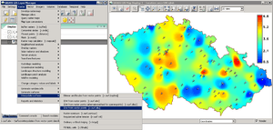
Graphical User Interface in GRASS | |
| Developer(s) | GRASS Development Team |
|---|---|
| Initial release | 1984 |
| Stable release | 7.0 / February 22, 2015 |
| Development status | Active |
| Written in | C, C++, Python, Tcl |
| Operating system | Cross-platform |
| Available in | English, Czech, French, German, Italian, Japanese, Polish, Spanish, Vietnamese, ... |
| Type | Geographic information system |
| License | GNU General Public License |
| Website | grass.osgeo.org |
GRASS GIS (Geographic Resources Analysis Support System) is a free, open source geographical information system (GIS) capable of handling raster, topological vector, image processing, and graphic data.[1]
GRASS GIS, commonly referred to as GRASS (Geographic Resources Analysis Support System), is a free and open source Geographic Information System (GIS) software suite used for geospatial data management and analysis, image processing, graphics and maps production, spatial and temporal modeling, and visualization. It contains over 350 modules to render maps and images on monitor and paper; manipulate raster, and vector data including vector networks; process multispectral image data; and create, manage, and store spatial data.
GRASS is released under the GNU General Public License (GPL), and it can be used on multiple platforms, including Mac OS X, Microsoft Windows and Linux. Users can interface with the software features through a graphical user interface (GUI) or by "plugging into" GRASS via other software such as QGIS. They can also interface with the modules directly through a bespoke shell that the application launches or by calling individual modules directly from a standard shell. The latest stable release version (LTS) is GRASS GIS 7, which is available since 2015
The GRASS Development Team is a multi-national group consisting of developers at numerous locations. GRASS is one of the eight initial Software Projects of the Open Source Geospatial Foundation.
Architecture
GRASS supports raster and vector data in two and three dimensions. The vector data model is topological, meaning that areas are defined by boundaries and centroids; boundaries cannot overlap within a single layer. This is in contrast with OpenGIS Simple Features, which define vectors more freely, much as a non-georeferenced vector illustration program does.
GRASS is designed as an environment in which tools that perform specific GIS computations are executed. Unlike GUI-based application software, the GRASS user is presented with a UNIX shell containing a modified environment that supports the execution of GRASS commands (known as modules). The environment has a state that includes such parameters as the geographic region covered and the map projection in use. All GRASS modules read this state and additionally are given specific parameters (such as input and output maps, or values to use in a computation) when executed. The majority of GRASS modules and capabilities can be operated via a graphical user interface (provided by a GRASS module), as an alternative to manipulating geographic data in a shell.
There are over 350 core GRASS modules included in the GRASS distribution, and over 100 add-on modules created by users and offered on the GRASS web site. The GRASS libraries and core modules are written in C; other modules are written in C, C++, Python, UNIX shell, Tcl, or other scripting languages. The GRASS modules are designed under the Unix philosophy and hence can be combined using python or shell scripting to create more complex or specialized modules by a user without knowledge of C programming.
There is cooperation between the GRASS and QGIS (Quantum GIS) projects. Recent versions of QGIS can be executed within the GRASS environment, allowing QGIS to be used as a user-friendly graphical interface to GRASS that more closely resembles other graphical GIS software than does the shell-based GRASS interface.
Another project exists to re-implement GRASS in Java as JGRASS.
History
GRASS (Geographic Resources Analysis Support System) has been under continuous development since 1982[2] and has involved a large number of federal US agencies, universities, and private companies. The core components of GRASS and the management of integration of efforts into GRASS releases was originally directed by the U.S. Army - Construction Engineering Research Laboratory (USA-CERL), a branch of the U.S. Army Corps of Engineers, in Champaign, Illinois. USA-CERL completed its last release of GRASS as version 4.1 in 1992, and provided five updates and patches to this release through 1995. USA-CERL also wrote the core components of the GRASS 5.0 floating point version.
The development of GRASS was started by the USA-CERL to meet the need of the United States military for software for land management and environmental planning. A key motivation was the National Environmental Policy Act. The development platform was UNIX running on VAX hardware. During 1982 through 1995, USA-CERL led the development of GRASS, with the involvement of numerous others, including universities and other federal agencies. USA-CERL officially ceased its involvement in GRASS after release 4.1 (1995), though development had been limited to minor patches since 1993. A group formed at Baylor University to take over the software, releasing GRASS 4.2. Around this period, a port of the software to Linux was made. In 1998, Markus Neteler, the current project leader, announced the release of GRASS 4.2.1, which offered major improvements including a new graphical user interface. In October 1999, the license of the originally public-domain GRASS software was changed to the GNU GPL in version 5.0.[3]
Subsequently, GRASS has evolved into a powerful software suite with a wide range of applications in many different areas of scientific research and engineering. For example, GRASS is used for estimating potential solar photovoltaic yield with r.sun.[4][5][6] GRASS is currently used in academic and commercial settings around the world, as well as many governmental agencies including NASA, NOAA, USDA, DLR, CSIRO, the National Park Service, the U.S. Census Bureau, USGS, and many environmental consulting companies.
The latest stable releast version (LTS), GRASS GIS 7, has been released in 2015, replacing the old stable branch (6.4) which was released in 2011. This latest version added many new features, including large data support, a fast topological 2D/3D vector engine, powerful vector network analysis, a full temporal framework and many other features and improvements.
GRASS development is currently split into a [ stable branch (7.0), and an experimental/development branch (7.1). The stable branch is recommended for most users, while the 7.1 branch operates as a testbed for new features.
See also
References
- ↑ Neteler, M.; Mitasova, H. (2008). Open Source GIS : a GRASS GIS approach (3rd ed.). New York: Springer. ISBN 978-0-387-35767-6.
- ↑ Westervelt, J. (2004). GRASS roots. FOSS/GRASS Users Conference. Bangkok, Thailand. pp. 12–14.
- ↑ GRASS Development Team. GRASS History. Retrieved on 2008-03-29.
- ↑ Nguyen, H.T.; Pearce, J.M. "Estimating potential photovoltaic yield with r.sun and the open source Geographical Resources Analysis Support System". Solar Energy 84 (5): 831–843. doi:10.1016/j.solener.2010.02.009. open access
- ↑ Hofierka J., Šúri M. (2002). The solar radiation model for Open source GIS: implementation and applications. Proceedings of the Open source GIS - GRASS users conference, Italy. Available: provides a detailed guide on how to run the module.
- ↑ Šúri, Marcel, and Jaroslav Hofierka. "A New GIS‐based Solar Radiation Model and Its Application to Photovoltaic Assessments." Transactions in GIS 8.2 (2004): 175-190.
Further reading
- Neteler, Markus; Bowman, M. Hamish; Landa, Martin; Metz, Markus (2012). "GRASS GIS: A multi-purpose open source GIS". Environmental Modelling & Software 31: 124–130. doi:10.1016/j.envsoft.2011.11.014.
- GDF Hannover bR: GRASS GIS 6.0 Tutorial, Version 1.2, 2005, Online Supplement
- Indian Example
- A.P. Pradeepkumar (2003) "Absolute Beginners Guide to Linux/GRASS installation" Online publication at GRASS Development Project Website
- 原著 A. P. Pradeepkumar (2003) GRASS 5.00 安装新手指南 in Chinese
External links
| Wikimedia Commons has media related to GRASS GIS. |
- GRASS GIS main web site, OSGeo foundation
- GRDSS, Geographic Resources Decision Support System (GRASS GUI)
- PyWPS (Python Web Processing Service with native support for GRASS)
- A (not so) short overview of the Geographic Information System GRASS