Future Interstate Highways
| Dwight D. Eisenhower National System of Interstate and Defense Highways | |
|---|---|
|
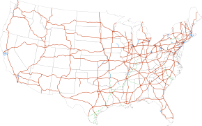
Interstate Highways in the 48 contiguous states | |
| System information | |
| Formed: | June 29, 1956[1] |
| Highway names | |
| Interstates: | Interstate X (I-X) |
| System links | |
Future Interstate Highways include various proposals to expand the Interstate Highway System in the United States. This does not include the numerous auxiliary Interstate Highways that are in various stages of planning and construction.
Congressionally designated future Interstates
Several Congressional High Priority Corridors have been designated as future parts of the Interstate System by the Intermodal Surface Transportation Efficiency Act and amendments. By law, they will become interstates when built to Interstate standards and connected to other interstates.[2][3]
Interstate 9
| |
|---|---|
| Location: | Wheeler Ridge – Stockton, CA |
Interstate 9 has been proposed by Caltrans for State Route 99 in central California. It would go from the split with I-5 at Wheeler Ridge (Wheeler Ridge Interchange) north through Fresno to Stockton, where the proposed route turns west via the State Route 4 freeway to a terminus at I-5 in the central part of that city. An alternate proposed terminus is located at the I-5/US 50/Capital City Freeway junction in Sacramento, where the future interstate, after continuing north from Stockton along Route 99, can turn west along the Capital City Freeway, already an Interstate route (unsigned I-305), to connect with I-5, which extends north toward the city of Redding. This also serves as a connector to the existing northern portion of Highway 99. The future Interstate's prospects for development to appropriate standards are tied to the Caltrans "Route 99 Corridor Enhancement Master Plan", which outlines improvements to that route, including capacity and physical improvements; this document posits that when and if Interstate status is conferred, the route will be designated I-7 or I-9.[4] In August 2005, with the passage of that year's SAFETEA-LU federal transportation legislation, SR 99 from Wheeler Ridge to Stockton and beyond to Sacramento was designated as High Priority Corridor 54, the California Farm-to-Market Corridor; this legislation also designated that corridor as a future segment of the Interstate System.[5]
Interstate 11
| |
|---|---|
| Location: | Tucson, AZ - Phoenix, AZ – Las Vegas, NV |
Interstate 11 is the congressionally-designated route number for an interstate connecting Phoenix, Arizona, to Las Vegas. This concept was first explored in the contractor-trade publication "Roads and Bridges" in June 1997; the article outlining the I-11 route and rationale was titled "Interstate 2000: Improvement for the Next Millennium", written by Wendell Cox and Jean Love. Their rationale was that the Phoenix and Las Vegas metro areas were two of the largest (and, circa 1997, growing) urban regions in adjacent states not featuring direct Interstate connection. The corridor would be approximately 285 miles in length and would most likely subsume the existing I-515 freeway facility in the Las Vegas area.[6] Plans to connect I-11 to the existing Interstate network in the Phoenix region have yet to be determined, but the most likely routing would extend west and southwest of the Phoenix metro complex via the proposed "Hassayampa" corridor. The proposed routing for I-11 is part of the Canamex high-priority corridor.[7] The projects contained within this portion of the overall Canamex corridor include the recently completed Hoover Dam Bypass project.[8][9][10][11] Note that there are not currently official plans to upgrade the highway to full freeway status between these cities, although the US 93 corridor is being presently upgraded to divided expressway status; along with a planned freeway bypass of the town of Wickenburg at the junction of US 60 and US 93.[12][13] Extensions into the Tucson area where the road will meet with Interstate 19 are already in planning.[14]
In July 2009, the Regional Transportation Commission of Southern Nevada passed a resolution, coinciding with recent resolutions from the City of Las Vegas, and several Arizona transportation agencies, to support a future Interstate 11. The Boulder City bypass on US 93 will be built to interstate standards and is currently in the planning stages.[15][16] Presently the text of the 2012 two-year highway reauthorization bill as passed by the Senate (S. 1813) includes a section that authorizes the sections of High Priority Corridor 26, the "Canamex" corridor, between Phoenix and Las Vegas as a future Interstate and further specifies the designation of I-11 to that routing.[17]
The language of the 2-year transportation bill as passed by both House and Senate as of June 28, 2012, retained the addition of the Canamex corridor as Future Interstate 11, including its actual numerical designation; this will write Interstate 11 into law with the expected signature of the President.[18] In March 2014, interim/future I-11 signage was applied along the nascent corridor in locations such as the O'Callaghan-Tillman Bridge (adjacent to Hoover Dam) and its approaches, and a brief segment of US 93 north of Kingman, AZ, at the Arizona State Route 68 junction; these are the only portions of the corridor, aside from extant I-515, presently meeting Interstate standards.[19][20][21]
Others
Proposed routes:
- Extensions of Interstate 49 from Shreveport, Louisiana, to Pineville, Missouri, and from Lafayette to New Orleans, Louisiana. This upgrade, completed in portions in both Arkansas and Missouri (but only the Missouri portion is signed as I-49 from Pineville to Kansas City), is being completed under the auspices of both the 1991 ISTEA legislation, which designated the corridor as "High Priority Corridor 1" and the subsequent 2005 SAFETEA-LU legislation, which reiterated the designation as High Priority Corridor 72 and, in the language of the following year's highway funding authorization bill, added language making HPC 72 an northern extension of Louisiana's I-49. In 2010 Missouri initiated the idea of converting US 71 between I-44 south of Carthage and I-435 south of Kansas City to a northerly section of I-49, which would involve converting several at-grade crossings to bridges and/or interchanges.[22]
- Extension of Interstate 66 westward, through West Virginia, southern Kentucky,[23] southern Missouri, and southeastern Kansas to Wichita.
- Interstate 73, established in 1997, currently routes from Ellerbe to Greensboro, in North Carolina. When completed, it will route from the South Carolina Grand Strand area to Grayling, Michigan. The completed route is to be Myrtle Beach to Hamlet, North Carolina; following I-74 to Greensboro; north to Roanoke, Virginia; following I-81 to Christiansburg; via Blacksburg to I-77 to Huntingdon; following I-74 to Piketon, Ohio; north to Columbus and Toledo; northwest to Jackson, Michigan; and north to Lansing before finally joining with I-75 south of Grayling.
- Extension of Interstate 74 from Cincinnati, Ohio, to the South Carolina Grand Strand area. I-74 currently runs from Davenport, Iowa, to Cincinnati. Work is progressing on the part running through the Winston-Salem and Greensboro areas of North Carolina as far as I-95. However there is little progress on the central section from Cincinnati to I-77 and the final southern extension from I-95 to south of Myrtle Beach.
- Interstate 99 from Bedford, Pennsylvania, to Corning, New York, and Bedford to Cumberland, Maryland (partially complete). This is part of High Priority Corridor #9 and, through the efforts of former area congressman Bud Shuster, was designated in the 1995 NHS legislation as I-99. The portion from I-70/76 (PA Turnpike) near Bedford to I-80 is substantially complete (pending upgrades of the I-80/I-99 interchange), while the portion from I-80 north to I-86 west of Corning, NY is being steadily upgraded to Interstate standards and is sporadically signed as "Future I-99".
Other proposals
Interstate 3
| |
|---|---|
| Location: | Savannah, GA – Knoxville, TN |
The 3rd Infantry Division Highway was proposed in the 2005 highway funding bill (Safe, Accountable, Flexible, Efficient Transportation Equity Act: A Legacy for Users) to run from Savannah, Georgia, north via Augusta, to Knoxville, Tennessee. Although the corridor has not been designated by law or any official body as a proposed Interstate, Interstate 3 is its popular name.[24] This number does not fit into the Interstate Highway numbering system, but matches the name chosen to honor the US Army Third Infantry Division.
Interstate 14
| |
|---|---|
| Location: |
Alexandria, LA – Augusta, GA or Natchez, MS – Augusta, GA |
The 14th Amendment Highway was proposed in the 2005 highway funding bill (Safe, Accountable, Flexible, Efficient Transportation Equity Act: A Legacy for Users) to run from Augusta, Georgia, through Macon, Columbus, Montgomery, Meridian, Jackson, to end in Natchez, Mississippi, or Alexandria, Louisiana. Although the corridor has not been designated by law or any official body as a proposed Interstate, Interstate 14 is its popular name.[24] This number fits into the Interstate Highway numbering system, and matches the name chosen to honor the 14th Amendment to the US Constitution.
Interstate 44
| |
|---|---|
| Location: | Raleigh, NC – Norfolk, VA |
| Length: | 192 mi (309 km) |
Interstate 44 (although some sources mention Interstate 50 as a possibility) is the designation proposed for assignment by the North Carolina Department of Transportation (NCDOT) to portions of the present I-495 and U.S. Route 64 in North Carolina and U.S. Route 17 in North Carolina and Virginia. The route would connect two of the largest US metro areas lacking an interstate connection: the Research Triangle area around Raleigh, North Carolina, with the Hampton Roads metro area centered on Norfolk, Virginia. In November 2012, NCDOT requested the addition of the corridor to the Interstate Highway System through administrative options with the Federal Highway Administration as I-44.[25] Congressman G. K. Butterfield introduced legislation in June 2014 to add the corridor to the Interstate Highway System through Congressional authority.[26] An NCDOT policy paper said they were "seeking language in the reauthorization of surface transportation programs legislation to enhance the description of the Raleigh–Norfolk Corridor to include the route via Rocky Mount/ Elizabeth City for clarity, and to designate the entire route from Raleigh to Norfolk as a future part of the Interstate system as Interstate 44 or 50."[27][28] If the I-44 designation is approved, it would be non-contiguous with the present Interstate 44, which runs between Wichita Falls, Texas and St. Louis, Missouri.
Interstate 61
| |
|---|---|
| Location: | Gulfport–Jackson, Mississippi |
Interstate 61 is a planned Interstate set to run from Gulfport to Jackson, Mississippi. This highway would follow the route of US Highway 49. The southern end of this highway would be at Interstate 10 close to the Cowan–Lorraine Road exit (exit 38) near the Biloxi–Gulfport line (the northern end is currently unknown). Interstate 61 from Gulfport to Wiggins was expected to be completed in 2011.[29]
Interstate 63
| |
|---|---|
| Location: | Mobile–Muscle Shoals, Alabama |
Interstate 63 is a planned Interstate set to run from Mobile (near Creola) to Muscle Shoals, Alabama, or possibly into Tennessee.
Interstate 67
| |
|---|---|
| Location: | Indianapolis, IN – Grand Rapids, MI; South Bend, IN –Kalamazoo, MI; Bowling Green, KY – Crane, IN |
Interstate 67 is a proposed number for at least three highways.
The first proposal would be an upgrade of US 31 in Indiana between Indianapolis and South Bend, continuing northward via the US 31 freeway north to Benton Harbor, Michigan, and going northward from there along existing Interstate 196. The Indiana Senate unanimously passed a resolution calling for federal funding for this proposal.[30] Meanwhile Indiana is expediting the upgrade of US-31 between Indianapolis and South Bend using funds received through the 2006 Major Moves deal (see U.S. Route 31 in Indiana). Such a proposal would put I-67 in the proper place in the grid (it is the only number available for that route). This number in fact was officially proposed by the Michigan State Highway Department,[31] but denied by AASHO, to follow what became Interstate 196 in 1963 as part of the switch with Interstate 96 west of their junction near Grand Rapids.[32]
Interstate 67 was also the designation given to a never-built highway connecting Kalamazoo, Michigan, to the east side of Elkhart, Indiana, in the original Interstate numbering plan.[33] A planning map shows a freeway along this routing intersecting the Indiana Toll Road just west of the State Road 19 interchange.[34]
A third, much shorter, likely proposal involves building a highway parallel to US 231 from Crane, Indiana, to Bowling Green, Kentucky. Much of the proposed route already exists and is close to Interstate grade. Only the northern third from Dale, Indiana, to Crane as remains unfinished. It would use the Natcher Bridge to cross the Ohio River and Kentucky's Interstate-grade Natcher Parkway and Indiana's Interstate-grade Lincoln Parkway. It would go around the cities of Jasper, Indiana, Huntingburg, Indiana, Owensboro, Kentucky, Hartford, Kentucky, Morgantown, Kentucky and end at Bowling Green, Kentucky. It could also be linked to the first proposal by overlapping I-67 with the currently under construction I-69 from Indianapolis to Crane.[35]
Interstate 92
| |
|---|---|
| Location: |
Albany, NY – Portsmouth, NH or Glens Falls, NY – Calais, ME |
Interstate 92 is a proposed number for at least two highways.
Low population and natural barriers like the White Mountains have impeded economic development in northern New England. In the early 1970s, Maine, New Hampshire, Vermont, and New York proposed two new Interstate Highway corridors:
- From Albany, New York, to Portsmouth, New Hampshire, incorporating the current route whose easternmost segment is New Hampshire Route 101.
- From Glens Falls, New York, to Calais, Maine (designated as I-92), tracing US Route 4 eastward through Vermont and New Hampshire.
The Federal Highway Administration ultimately did not approve these plans.
Northern New England is served by three north–south freeways radiating from Boston, and by Interstate 91, which follows the Connecticut River. However, the northernmost complete east–west freeway in the region, Interstate 90 in Massachusetts, does not enter northern New England. East–west travel through northern New England is facilitated by three freeway segments:
- Interstate 89 between Montpelier, Vermont, and Burlington.
- US 4 west of Rutland, Vermont.
- New Hampshire Route 101 from Manchester, New Hampshire eastward to the ocean.
Maine Senator Olympia Snowe said in 2004 that the region is disadvantaged by the fact that it was the only region in the US for which a federal High Priority Corridor was not designated in the 1991 Intermodal Surface Transportation Efficiency Act.[36] In 2012, the east–west highway was again proposed, this time as a privately financed toll road.[37]
Current backers of the highway propose an east–west axis through northern and central Maine. One portion of the new highway would run from Interstate 395 in Brewer, Maine, to the Canada-U.S. border near Calais, with a direct link to New Brunswick Route 1, a major transportation corridor serving the Maritimes. A second would travel northwest from Interstate 95 near Waterville, Maine, to the Canada-U.S. border at Coburn Gore, with a connection to a proposed extension of Quebec Autoroute 10 toward Montreal. A third would travel due west from I-95 near Waterville, following the U.S. Route 2 corridor through Maine, New Hampshire, Vermont, and northern New York.
Interstate 98
| |
|---|---|
| Location: | Watertown NY–Swanton VT |
As originally proposed by the Michigan State Highway Department in 1958, I-696 would have been numbered I-98.[31] Since then, another highway in Upstate New York & Vermont has been linked to the number. Plans for the Rooftop Highway, a proposed limited-access highway that would extend for 175 miles (282 km) from Watertown NY to Swanton VT, first surfaced in the 1950s. If built, the highway would likely follow the US 11 corridor across the northern part of North Country, connecting I-81 to I-89. The project is expected to create more than 27,000 jobs throughout the North Country and is expected to take as many as 15 years to complete.
A study called the North Country Transportation Study Action Plan and Final Technical Report suggests that the road would likely be built to Interstate Highway standards in order to improve constrained transit systems due to a lack of infrastructure throughout the area. Backers of the project have called for the highway to be designated as I-98;[38] however, this designation has not been recognized by any government agencies, such as NYSDOT or the American Association of State Highway and Transportation Officials (AASHTO). The number does fit into AASHTO's numbering system, though, as the highest even numbers are designated for highways running along the Canada–United States border, such as the proposed highway.
The Northern Corridor Transportation Group (NCTG) was formed in December 2008 as a means of refocusing the fifty-year discussion on the project. Since that time, more than 100 municipal and civic resolutions from the five northern counties of New York have been passed in support of the construction of the project. On July 16, 2009, the NCTG submitted a request to U.S. Senator Kirsten Gillibrand to direct $800 million toward the project as part of the reauthorization of a federal highway transportation bill. In a historic move, the six northern legislators representing the North Country in the New York State Legislature (Senators Aubertine, Griffo and Little and Assembly Members Scozzafava, Russell and Duprey) signed an official letter of request to the same end.
Interstate 99 or 101
| |
|---|---|
| Location: | Charleston, SC–Wilmington, DE |
| |
|---|---|
| Location: | Raleigh, NC-Philadelphia, PA |
Although Interstate 99 already exists in central Pennsylvania, an alternate corridor, designated "Interstate 99" by the Virginia Department of Transportation (VDOT), was under study in the states of Delaware, Maryland, Virginia, North Carolina and South Carolina in the mid-2000s. Such a corridor would follow the U.S. Route 17 (US 17) and US 13 corridors, from Charleston, South Carolina, through the Norfolk–Virginia Beach metro area and across the Chesapeake Bay Bridge-Tunnel complex, up the Delmarva Peninsula to Wilmington, Delaware.[39] If the proposal were to be constructed and approved, it is unclear as to whether it would receive the "I-99" designation.
However after commissioning a study in 2006, VDOT dismissed the proposal for several reasons. VDOT indicated that expenses in upgrading the Chesapeake Bay tunnels would be about $5 billion. Also cited were the location of new highway alignments, doubt as to whether other states, particularly South Carolina, would commit to the endeavor.[39]
Although much of the highway mileage along the corridor would need to be upgraded to be eligible for Interstate status, portions of highway along the corridor have already been upgraded. In the 1990s, Delaware constructed a limited access facility on Delaware Route 1, paralleling US 13 from Dover to Wilmington. Additionally, Delaware has considered upgrading the US 113 corridor south of Dover,[39] though, this deviates from the path suggested by VDOT. In Maryland, a portion of US 13 is routed along a limited-access bypass around Salisbury.
The corridor has also sometimes been described as a potential Interstate 101 along the same coastal corridor, including crossing the Chesapeake Bay Bridge-Tunnel complex. I-101 would run from I-95, near Philadelphia, Pennsylvania, to I-85, near Raleigh, North Carolina, instead.[6]
A portion of both routes would be covered by the newer proposal for I-44 as noted above.
References
- ↑ Weingroff, Richard F. (Summer 1996). "Federal-Aid Highway Act of 1956, Creating the Interstate System". Public Roads (Washington, DC: Federal Highway Administration) 60 (1). Retrieved March 16, 2012.
- ↑ United States Congress. "National Highway System Designation Act of 1995". Library of Congress.
- ↑ Staff (May 2, 2006). "Future Interstates on the National Highway System Designated by Section 1105 of ISTEA as amended". Federal Highway Administration. Archived from the original on September 26, 2006.
- ↑ "Chapter 3" (PDF). Caltrans Route 99 Enhancement Plan (PDF). California Department of Transportation.
Interstate designation, under the current proposal, would apply to the 260-mile (420 km) segment between the junction of State Route 99 with I-5 south of Bakersfield to I-5 in Stockton using State Route 4 as the connector to I-5. Since there is an I-99 route currently in existence in Pennsylvania, it is anticipated that should designation be granted, the Route 99 designation would become I-9 to satisfy Interstate numbering convention.
- ↑ United States Congress. "Safe, Accountable, Flexible, Efficient Transportation Equity Act: A Legacy for Users". Library of Congress.
- ↑ 6.0 6.1 Cox, Wendell & Love, Jean (June 1997). "Interstate 2000: Improvement for the Next Millenium". Roads & Bridges. Retrieved December 1, 2013.
- ↑ Proposed Hassayampa Freeway map (Map). Las Vegas Sun.
- ↑ "Hoover Dam Bypass". Central Federal Lands Highway Division and HDR Engineering.
- ↑ "US 93 corridor in Arizona". Arizona Department of Transportation. Retrieved June 2, 2013.
- ↑ "Quick Status Update and Upcoming Activities: July–August 2009" (PDF) (Press release). Hoover Dam Bypass Project.
- ↑ Norman, Jean Reid (August 12, 2009). "Boulder City Council endorses Vegas-to-Phoenix interstate". Las Vegas Sun.
- ↑ "High Priority Corridors, Canamex (Corridor 26)". AARoads.com. Self-published.
- ↑ "Western Roads". AARoads.com. Self-published.
- ↑ http://azstarnet.com/business/local/tucson-may-see-another-interstate/article_826cbc8a-059d-5e30-b25e-613adc5e6a7d.html
- ↑ "Freeway to Phoenix gains traction with bridge work". Las Vegas Sun. July 11, 2009.
- ↑ "Boulder City Bypass". Nevada Department of Transportation.
- ↑ "S. 1813 (2012)" (PDF). Library of Congress. Sec. 1104(c)(5)(b)(2). Retrieved May 20, 2012.
- ↑ Holstege, Sean (June 28, 2012). "Bill for Phoenix to Vegas freeway advances". Arizona Republic (Phoenix, AZ).
- ↑ http://www.azdot.gov/media/blog/posts/2014/03/25/new-i-11-signs-mark-congressionally-designated-corridor
- ↑ http://www.reviewjournal.com/news/nevada/nevada-arizona-governors-unveil-i-11-signs-future-interstate-route/
- ↑ http://azstarnet.com/news/state-and-regional/future-i--signs-go-up-north-of-phoenix/article_e27c217a-6f81-53d3-97d8-10e8789af2c3.html
- ↑ "I-49 Coming to Missouri" (Press release). Missouri Department of Transportation. August 12, 2010. Retrieved July 5, 2012.
- ↑ "Interstate 66 Kentucky". Kentucky Transportation Cabinet.
- ↑ 24.0 24.1 "SAFETEA-LU Section 1927". Safe, Accountable, Flexible, Efficient Transportation Equity Act: A Legacy for Users. Federal Highway Administration. March 8, 2011. Retrieved July 5, 2012.
- ↑ Gibson, Terry R. (November 27, 2012). "Designation of I-44" (PDF) (Letter to John F. Sullivan III). Raleigh, NC: North Carolina Department of Transportation. Retrieved May 15, 2014.
- ↑ Tata, Anthony J. (June 11, 2014). "Route to Opportunity and Development Act (ROAD Act_" (PDF) (Letter to G.K. Butterfield). North Carolina Department of Transportation. Retrieved September 4, 2014.
- ↑ "Future Interstate Designation: Raleigh, NC to Norfolk, VA" (PDF). North Carolina Department of Transportation. June 11, 2014. Retrieved September 4, 2014 – via Regional Transportation Alliance.
- ↑ "Interstate 495 to Rocky Mount—Future I-44 to Hampton Roads". Raleigh, NC: Regional Transportation Alliance. December 14, 2013. Retrieved February 16, 2014.
- ↑ Lee, Anita (October 29, 2004). "Gulfport to Wiggins Interstate Sought". Sun Herald (Biloxi, MS).
- ↑ "Zakas' Resolution Passes Senate Unanimously; Bill supports efforts of Indiana Congressional Delegation to seek federal funding for US 31 freeway project" (Press release). State of Indiana Senate District 11. Archived from the original on March 11, 2007. Retrieved July 6, 2009.
- ↑ 31.0 31.1 Staff (April 25, 1958). Recommended Interstate Route Numbering for Michigan (Report). Michigan State Highway Department. Archived from the original on August 5, 2004. Retrieved September 4, 2010.
- ↑ "Would Shift Route Number: Mackie Seeks Int. 96 Designation for Grand Rapids–Muskegon Stretch". The Grand Rapids Press. May 1, 1963. p. 31. OCLC 9975013.
- ↑ Official Route Numbering for the National System of Interstate and Defense Highways (Map). Cartography by Public Roads Administration. American Association of State Highway Officials. August 14, 1957.
- ↑ "FAI9 1957". Indiana Interstates: 1957 Interstate Highway System. Archived from the original on June 23, 2002. Retrieved May 7, 2008.
- ↑ GO-EDC (January 13, 2012). "Facts about Interstate 67 as Owensboro's interstate". Owensboro Economic Development Blog. Greater Owensboro Economic Development Corporation. Retrieved October 10, 2012.
- ↑ Senator Olympia Snowe (June 25, 2004). "East–West Highway Will Connect Mainers to All Points In-Between and Beyond". Weekly Senate Update.
- ↑ "Transportation Committee passes bill for east-west highway study". Bangor Daily News. Retrieved February 18, 2012.
- ↑ "It's now I-98, not Rooftop Highway". Adirondack Daily Enterprise (Saranac Lake, NY). August 1, 2009. Retrieved February 2, 2011.
- ↑ 39.0 39.1 39.2 Homer, Pierce R. (November 2006). "Construction of I-99: Appropriation Act Item 427 H. (Special Session I, 2006)" (PDF). Virginia Department of Transportation. Retrieved August 10, 2013.
External links
| ||||||||||||||||||||||||||||