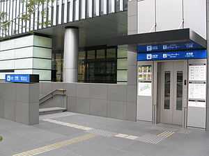
Fushimi Station (Aichi)
Fushimi Station 伏見駅 | |
 | |
|---|---|
| Location | |
| Prefecture | Aichi (See other stations in Aichi) |
| City | Nagoya |
| Ward | Naka |
| Neighborhood etc. | Nishiki 2-16-24 |
| Postal code | 460-0003 |
| (in Japanese) | 名古屋市中区錦二丁目16-24 |
| History | |
| Year opened | 1957 |
| Former name | Fushimi-chō Station |
| Present name since | 1966 |
| Rail services | |
| Station number(s) | H09 T07 |
| Operator(s) | Transportation Bureau City of Nagoya |
| Line(s) | Higashiyama Line Tsurumai Line |
| Statistics | 41,884 passengers/day 2009 |
Fushimi Station (伏見駅 Fushimi-eki) is an underground metro station located in Naka-ku, Nagoya, Aichi Prefecture, Japan operated by the Nagoya Municipal Subway.[1] The station is an interchange station between the Tsurumai Line and the Higashiyama Line, and is located 7.0 rail kilometers from the terminus of the Tsurumai Line at Kami-Otai Station and 8.0 rail kilometers from the terminus of the Higashiyama Line at Takabata Station.
History
Fushimi Station was opened on 15 November 1957 as Fushimi-chō Station (伏見町駅 Fushimi-chō-eki) on the Higashiyama Line. It was renamed to its present name on 1 June 1966. The Tsurumai Line connected to the station on 18 March 1977.[2]
Lines
- Nagoya Municipal Subway
- Higashiyama Line (Station number: H09)
- Tsurumai Line (Station number: T07)
Layout
Fushimi Station has two pair of underground opposed side platforms, built on different levels.
Platforms
| 1 | ■Higashiyama Line | For Sakae, Higashiyama Kōen, and Fujigaoka |
| 2 | ■Higashiyama Line | For Nagoya and Takabata |
| 3 | ■Tsurumai Line | For Yagoto, Akaike, and Toyotashi |
| 4 | ■Tsurumai Line | For Kami-Otai, Iwakura, and Inuyama |
There are three wickets, the North Wicket, Central Wicket, and South Wicket.[3]
Adjacent stations
| « | Service | » | ||
|---|---|---|---|---|
| Nagoya Municipal Subway | ||||
| Higashiyama Line | ||||
| Nagoya | - | Sakae | ||
| Tsurumai Line | ||||
| Marunouchi | - | Ōsu Kannon | ||
External links
- Fushimi Station official web site (Japanese)
| Wikimedia Commons has media related to Fushimi Station (Aichi). |
References
- ↑ 伏見 [Fushimi] (in Japanese). Transportation Bureau City of Nagoya. Retrieved 21 November 2010.
- ↑ 佐藤, 信之 (19 June 2004), "高度経済成長期の鉄道整備―昭和30~40年代", 地下鉄の歴史首都圏・中部・近畿圏 (in Japanese), グランプリ出版, p. 63, ISBN 4-87687-260-0
- ↑ 駅構内図 [Diagram of Station Interior] (in Japanese). Transportation Bureau City of Nagoya. Retrieved 21 November 2010.
| ||||||
| ||||||