Fritz Cove
| Fritz Cove | |
|---|---|
| Location |
Stephens Passage, Juneau, Alaska |
| Coordinates | 58°19′41″N 134°38′30″W / 58.32806°N 134.64167°WCoordinates: 58°19′41″N 134°38′30″W / 58.32806°N 134.64167°W |
| River sources |
Cove Creek, Elevenmile Creek, Fish Creek |
| Basin countries | United States |
| Max. depth | 30 fathoms (55 m) |
| Islands | Spuhn Island |
Fritz Cove is a bay on the northwestern coast of Douglas Island in the City and Borough of Juneau, Alaska, United States.[1] Lying in Stephens Passage, it is 8 miles (13 km) northwest of the city of Juneau.
Historically, Fritz Cove was used for fishing by Alaska Natives, especially the Auke people. A summer camp named Aangoox̱a Yé was located at the mouth of Fish Creek.[2] Scottish-American naturalist John Muir camped at the bay on November 10, 1879.[3]
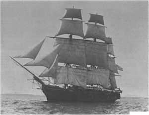
The area was surveyed by the USS Jamestown in 1880;[4][5] Lieutenant F. M. Symonds named the bay after his son. The name was first published by the U.S. Coast and Geodetic Survey in 1881, collected by the United States Geological Survey between 1976 and 1981, and entered into the Geographic Names Information System on March 31, 1981.[6]
Fritz Cove and Gastineau Channel became linked in 1960 through a United States Army Corps of Engineers effort to dredge a navigation route.[7]
Streams flowing into Fritz Cove include Cove Creek,[8] Elevenmile Creek,[9] and Fish Creek.[10] Islands in the bay include Spuhn Island.[11] Depths in the bay range from 8 to 30 fathoms (15 to 55 m).[12]

Dungeness crabs,[13] Tanner crabs,[14] and king salmon[15] live in the cove; molting of the male Tanner crabs in the cove has been documented since the 1970s.[16] Scoters, grebes, mergansers, and marbled murrelets can also be seen in the area.[17]
References
- ↑ U.S. Coast and Geodetic Survey. United States Coast Pilot: Alaska, Part I: Dixon Entrance to Yakutat Bay, Sixth Edition, p. 158. Government Printing Office: Washington, 1917.
- ↑ Goldschmidt, Walter R., and Haas, Theodore H. Haa Aaní, Our Land: Tlingit and Haida Land Rights and Use. Sealaska Corporation, 1998.
- ↑ Muir, John; Engberg, Robert (ed.); and Merrell, Bruce (ed.) Letters from Alaska. University of Wisconsin Press: Madison, Wisconsin, 1993.
- ↑ Annual Report of the Hydrographic Office for the Fiscal Year 1924. Government Printing Office: Washington, 1924.
- ↑ U.S.S. Jamestown Warship and Her Personnel, 1880 and 1881. Alaska Trails to the Past. Accessed June 23, 2010.
- ↑ USGS GNIS Feature Detail Report: Fritz Cove. Accessed July 23, 2010.
- ↑ Pursell, Jenny (July 11, 2004). "Trek through 'the flats' reveals beauty of wetlands". Juneau Empire. Retrieved December 11, 2010.
- ↑ USGS GNIS Feature Detail Report: Cove Creek. Accessed July 23, 2010.
- ↑ USGS GNIS Feature Detail Report: Elevenmile Creek. Accessed July 23, 2010.
- ↑ USGS GNIS Feature Detail Report: Fish Creek. Accessed July 23, 2010.
- ↑ USGS GNIS Feature Detail Report: Spuhn Island. Accessed July 23, 2010.
- ↑ U.S. Coast and Geodetic Survey. Table of Depths for Channels and Harbors, p. 117. Government Printing Office: Washington, 1913.
- ↑ Stone, Robert P., and O'Clair, Charles E. "Behavior of Female Dungeness Crabs, Cancer magister, in a Glacial Southeast Alaska Estuary: Homing, Brooding-Site Fidelity, Seasonal Movements, and Habitat Use". Journal of Crustacean Biology. May 2002.
- ↑ Stone, Robert P. "Mass Molting of Tanner Crabs Chionoecetes bairdi in a Southeast Alaska Estuary" PDF (121.55 KB) Alaska Fishery Research Bulletin, Volume 6, No. 1. Summer 1999. Accessed July 23, 2010.
- ↑ Wallace, Brian (October 5, 2008). "A fisherman's Elegy". Juneau Empire. Retrieved July 23, 2010.
- ↑ Golden, Kate (April 13, 2008). "Shells litter Douglas Island beach as Tanner crabs molt en masse". Juneau Empire. Retrieved December 11, 2010.
- ↑ Willson, Mary F. (February 19, 2006). "On the Trails: Kingfishers, Dollies, crows can be found on Fish Creek Trail". Juneau Empire. Retrieved December 11, 2010.
Further reading
- James, Bushrod Washington. Alaska: Its Neglected Past, Its Brilliant Future. The Sunshine Publishing Company: Philadelphia, 1897.
- Miller, Mike. Alaska's Southeast: Touring the Inside Passage. Morris Book Publishing. Eleventh edition, 2008.