Friedland, Mecklenburg-Vorpommern
| Friedland | ||
|---|---|---|
| ||
 Friedland | ||
Location of Friedland within Mecklenburgische Seenplatte district 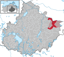 | ||
| Coordinates: 53°39′N 13°32′E / 53.650°N 13.533°ECoordinates: 53°39′N 13°32′E / 53.650°N 13.533°E | ||
| Country | Germany | |
| State | Mecklenburg-Vorpommern | |
| District | Mecklenburgische Seenplatte | |
| Municipal assoc. | Friedland | |
| Government | ||
| • Mayor | Wilfried Block | |
| Area | ||
| • Total | 132.62 km2 (51.20 sq mi) | |
| Population (2013-12-31)[1] | ||
| • Total | 6,122 | |
| • Density | 46/km2 (120/sq mi) | |
| Time zone | CET/CEST (UTC+1/+2) | |
| Postal codes | 17098 | |
| Dialling codes | 039601 | |
| Vehicle registration | MST | |
| Website | www.friedland-mecklenburg.de | |


St. Mary of Friedland
Friedland is a town in the district Mecklenburgische Seenplatte, Mecklenburg-Western Pomerania, Germany.
It is only 22 km from the district seat and bigger town Neubrandenburg, but still Friedland remains a local center for surrounding communities like Galenbeck (Kotelow, Lübbersdorf, Schwichtenberg), Brunn and Boldekow, and has approximately 6,800 citizens.
It was founded in 1244 by the Prince-electors Otto and Johann of Brandenburg, then having the name Vredeland.
References
- ↑ "Bevölkerungsstand der Kreise, Ämter und Gemeinden in Mecklenburg-Vorpommern 31.12.2013". Statistisches Amt Mecklenburg-Vorpommern (in German). 23 September 2014.
External links
 Media related to Friedland (Mecklenburg) at Wikimedia Commons
- http://www.friedland-mecklenburg.de - Official website