Frettenham
| Frettenham | |
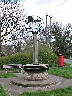 The village sign, incorporating a millstone from Frettenham Mill |
|
 Frettenham |
|
| Area | 6.33 km2 (2.44 sq mi) |
|---|---|
| Population | 727 |
| – density | 115/km2 (300/sq mi) |
| OS grid reference | TG246174 |
| Civil parish | Frettenham |
| District | Broadland |
| Shire county | Norfolk |
| Region | East |
| Country | England |
| Sovereign state | United Kingdom |
| Post town | NORWICH |
| Postcode district | NR12 |
| Police | Norfolk |
| Fire | Norfolk |
| Ambulance | East of England |
| EU Parliament | East of England |
Coordinates: 52°42′31″N 1°19′25″E / 52.708531°N 1.323509°E
Frettenham is a civil parish in the English county of Norfolk. Known in the Domesday Book as 'Fretham', Frettenham is located six miles north-east of Norwich, surrounded by countryside. The village is well known for its rich farmland.[1] It covers an area of 6.33 km2 (2.44 sq mi) and had a population of 727 in 288 households at the 2001 census.[2] For the purposes of local government, it falls within the district of Broadland.
The parish church of St Swithin dates from the 14th century; the chancel was rebuilt in 1869 by the architest Richard Phipson. [3]

See also
Notes
- ↑ Broadland and District Council- Frettenham. Retrieved 16 May 2010.
- ↑ Census population and household counts for unparished urban areas and all parishes. Office for National Statistics & Norfolk County Council (2001). Retrieved 20 June 2009.
- ↑ "Name: CHURCH OF ST SWITHIN List entry Number: 1372955". English Heritage. Retrieved 13 March 2014.
External links
![]() Media related to Frettenham at Wikimedia Commons
Media related to Frettenham at Wikimedia Commons
| ||||||||||||||