Fresnes-Tilloloy
| Fresnes-Tilloloy | |
|---|---|
|
Town hall | |
 Fresnes-Tilloloy | |
|
Location within Picardy region  Fresnes-Tilloloy | |
| Coordinates: 49°59′05″N 1°46′05″E / 49.9847°N 1.7681°ECoordinates: 49°59′05″N 1°46′05″E / 49.9847°N 1.7681°E | |
| Country | France |
| Region | Picardy |
| Department | Somme |
| Arrondissement | Amiens |
| Canton | Oisemont |
| Intercommunality | Canton of Oisemont |
| Government | |
| • Mayor (2001–2008) | Gérard Houbart |
| Area1 | 3.52 km2 (1.36 sq mi) |
| Population (2006)2 | 139 |
| • Density | 39/km2 (100/sq mi) |
| INSEE/Postal code | 80354 / 80140 |
| Elevation |
89–116 m (292–381 ft) (avg. 115 m or 377 ft) |
|
1 French Land Register data, which excludes lakes, ponds, glaciers > 1 km² (0.386 sq mi or 247 acres) and river estuaries. 2 Population without double counting: residents of multiple communes (e.g., students and military personnel) only counted once. | |

Fresnes-Tilloloy (or Fresne-Tilloloy[1]) is a commune in the Somme département in the Picardie region of France.
Geography
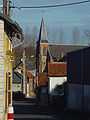
The commune is situated 10 miles (16 km) southwest of Abbeville on the D25 road
Population
| Year | 1962 | 1968 | 1975 | 1982 | 1990 | 1999 | 2006 |
|---|---|---|---|---|---|---|---|
| Population | 147 | 134 | 130 | 134 | 130 | 137 | 139 |
| From the year 1962 on: No double counting—residents of multiple communes (e.g. students and military personnel) are counted only once. | |||||||
History
The name is derived from the French for the Linden (Limetree)(fr: tilleul) and the Ash(fr: frêne).[2] and reference to the village (as Fresnum) is mentioned in 1207.
Tilloloy was also noted in 1373 as Thillolay[3]
Thilloloy and Fresnes were joined as one commune sometime between 1790 and 1794 as the commune of Fresnes-Thilloloy.
Traces of Gallo-Roman settlement have been found in the area, and the Roman road (the "chaussée de Brunehaut" is nearby[4]
In 1346, Edward III, spent some time here[5]
The commune was occupied from 17 February to 9 March 1871 by the Germans during the Franco-Prussian War.
.JPG)
Places of interest
- The Mairie[6] which also houses the school.
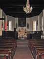
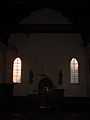
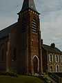
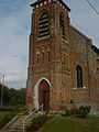
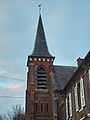
- The medieval church, part demolished and rebuilt in 1860, is dedicated to Saint-Ouen.
-
Autel de l'Eglise vu de l'entrée
-
Entrée de l'Eglise vu de l'Autel
-
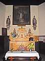
Autel de l'Eglise
-

Autel dédié à la Sainte-Vierge
-
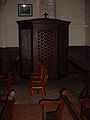
Confessionnal de l'Eglise
-

Reste de la Chaire
-
-
-
-
-
.JPG)
- The cemetery
.JPG)
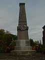
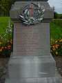
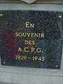
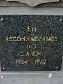
- The war memorial
See also
References
- ↑ Source Cassini
- ↑ Source cassini
- ↑ Autre écriture de Tilloloy, source books.google.com
- ↑ Pruvot - « Notice géographique et historique » du 10 juin 1899
- ↑ Baie de Somme
- ↑ Annuaire Mairie
External links
| Wikimedia Commons has media related to Fresnes-Tilloloy. |
- Fresne-Tilloloy on the Quid website (French)
- "joan-of-arc-studies" (English)
- Historique des Régiments de 1914-18 (French)