Freer, Texas
| Freer, Texas | |
|---|---|
| City | |
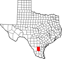
 Location of Freer, Texas | |
 | |
| Coordinates: 27°52′45″N 98°36′58″W / 27.87917°N 98.61611°WCoordinates: 27°52′45″N 98°36′58″W / 27.87917°N 98.61611°W | |
| Country | United States |
| State | Texas |
| County | Duval |
| Area | |
| • Total | 4.1 sq mi (10.5 km2) |
| • Land | 4.0 sq mi (10.4 km2) |
| • Water | 0.0 sq mi (0.1 km2) |
| Elevation | 518 ft (158 m) |
| Population (2000) | |
| • Total | 3,241 |
| • Density | 804.3/sq mi (310.5/km2) |
| Time zone | Central (CST) (UTC-6) |
| • Summer (DST) | CDT (UTC-5) |
| ZIP code | 78357 |
| Area code(s) | 361 |
| FIPS code | 48-27432[1] |
| GNIS feature ID | 1336186[2] |

Freer is a city in Duval County, Texas, United States. The population was 3,241 at the 2000 census. The city and county are heavily Hispanic in ethnicity and Democratic in voting history. From the 1930s-1960s, the county was dominated by the political boss, called a patron in South Texas, George Parr, a supporter of U.S. President Lyndon B. Johnson. Parr's influence waned thereafter, and he committed suicide at his Los Harcones ranch in 1975.
Like Sweetwater, the seat of Nolan County in West Texas, Freer holds an annual rattlesnake roundup in March.
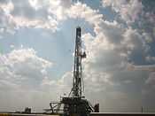
The first oil well in Texas was drilled in Freer in 1860, a year after the discovery in Titusville, Pennsylvania, but it was unproductive. In 1907, oil was again discovered in Duval County, six years after Spindletop near Beaumont.
Geography
Freer is located at 27°52′45″N 98°36′58″W / 27.87917°N 98.61611°W (27.879156, -98.616237).[3]
According to the United States Census Bureau, the city has a total area of 4.1 square miles (11 km2), of which, 4.0 square miles (10 km2) of it is land and 0.04 square miles (0.10 km2) of it (0.98%) is water.
Demographics
As of the census[1] of 2000, there were 3,241 people, 1,111 households, and 845 families residing in the city. The population density was 804.3 people per square mile (310.5/km²). There were 1,334 housing units at an average density of 331.1 per square mile (127.8/km²). The racial makeup of the city was 80.59% White, 0.46% African American, 0.68% Native American, 0.25% Asian, 14.87% from other races, and 3.15% from two or more races. Hispanic or Latino of any race were 77.38% of the population.
There were 1,111 households out of which 42.0% had children under the age of 18 living with them, 56.3% were married couples living together, 14.3% had a female householder with no husband present, and 23.9% were non-families. 21.5% of all households were made up of individuals and 9.2% had someone living alone who was 65 years of age or older. The average household size was 2.92 and the average family size was 3.40.
In the city the population was spread out with 33.1% under the age of 18, 9.8% from 18 to 24, 26.3% from 25 to 44, 19.9% from 45 to 64, and 10.9% who were 65 years of age or older. The median age was 30 years. For every 100 females there were 95.9 males. For every 100 females age 18 and over, there were 96.2 males.
The median income for a household in the city was $25,078, and the median income for a family was $26,475. Males had a median income of $26,789 versus $17,159 for females. The per capita income for the city was $11,457. About 18.4% of families and 21.6% of the population were below the poverty line, including 26.5% of those under age 18 and 25.4% of those age 65 or over.
| Historical population | |||
|---|---|---|---|
| Census | Pop. | %± | |
| 1940 | 2,346 | — | |
| 1950 | 2,280 | −2.8% | |
| 1960 | 2,734 | 19.9% | |
| 1970 | 2,804 | 2.6% | |
| 1980 | 3,213 | 14.6% | |
| 1990 | 3,271 | 1.8% | |
| 2000 | 3,241 | −0.9% | |
Education
The City of Freer is served by the Freer Independent School District.
Notable people
- Jim Acker, baseball player
- Paul Sadler, Texas politician, was born in Freer in 1955.
- Buddy Temple (R), a lumber magnate from Lufkin and former member of the Texas House of Representatives and the Texas Railroad Commission, operates a ranch near Freer.[4]
Media
Climate
The climate in this area is characterized by hot, humid summers and generally mild to cool winters. According to the Köppen Climate Classification system, Freer has a humid subtropical climate, abbreviated "Cfa" on climate maps.[6]
References
- ↑ 1.0 1.1 "American FactFinder". United States Census Bureau. Retrieved 2008-01-31.
- ↑ "US Board on Geographic Names". United States Geological Survey. 2007-10-25. Retrieved 2008-01-31.
- ↑ "US Gazetteer files: 2010, 2000, and 1990". United States Census Bureau. 2011-02-12. Retrieved 2011-04-23.
- ↑ "Advisory Board". ckwri.tamuk.edu. Retrieved May 16, 2012.
- ↑ "KBRA". FindTheData FM Radio Stations. Retrieved 2013-09-14.
- ↑ Climate Summary for Freer, Texas
External links
| |||||||||||||||||||||||||||||