Fredersdorf-Vogelsdorf
| Fredersdorf-Vogelsdorf | ||
|---|---|---|
|
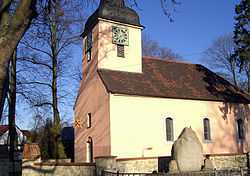
Vogelsdorf's church | ||
| ||
 Fredersdorf-Vogelsdorf | ||
Location of Fredersdorf-Vogelsdorf within Märkisch-Oderland district 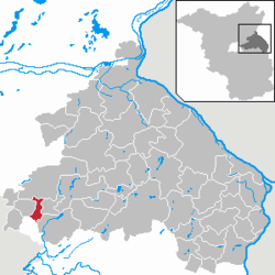 | ||
| Coordinates: 52°30′00″N 13°43′00″E / 52.50000°N 13.71667°ECoordinates: 52°30′00″N 13°43′00″E / 52.50000°N 13.71667°E | ||
| Country | Germany | |
| State | Brandenburg | |
| District | Märkisch-Oderland | |
| Government | ||
| • Mayor | Wolfgang Thamm (Ind.) | |
| Area | ||
| • Total | 16.36 km2 (6.32 sq mi) | |
| Population (2012-12-31)[1] | ||
| • Total | 12,626 | |
| • Density | 770/km2 (2,000/sq mi) | |
| Time zone | CET/CEST (UTC+1/+2) | |
| Postal codes | 15370 | |
| Dialling codes | 033439 | |
| Vehicle registration | MOL | |
| Website | www.fredersdorf-vogelsdorf.de | |

Fredersdorf-Vogelsdorf is a municipality in the district Märkisch-Oderland, in Brandenburg, Germany.
Geography
The municipality, situated 23 km east of Berlin centre, is composed by the main settlement of Fredersdorf and by Vogelsdorf.
Demography
-
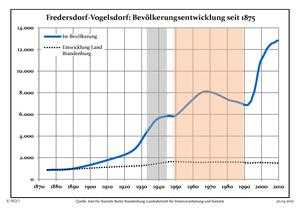
Development of Population since 1875 within the Current Boundaries (Blue Line: Population; Dotted Line: Comparison to Population Development of Brandenburg state; Grey Background: Time of Nazi rule; Red Background: Time of Communist rule)
-
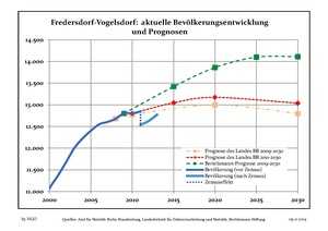
Recent Population Development (Blue Line) and Forecasts
Transport
The village is well connected to Berlin by the S-Bahn line S5 at the station of Fredersdorf.
Twin towns
Fredersdorf-Vogelsdorf is twinned with:
-
 Marquette-lez-Lille (France)
 -
 Sleaford, Lincolnshire, England (since 2009)[2]
References
- ↑ "Bevölkerung im Land Brandenburg nach amtsfreien Gemeinden, Ämtern und Gemeinden 31. Dezember 2012 (XLS-Datei; 83 KB) (Einwohnerzahlen auf Grundlage des Zensus 2011)". Amt für Statistik Berlin-Brandenburg (in German). 31 December 2012.
- ↑ "Home - Why not get involved with twinning". Sleaford, Lincolnshire, United Kingdom: Sleaford & District Twinning Association. Retrieved 29 April 2012.
External links
![]() Media related to Fredersdorf-Vogelsdorf at Wikimedia Commons
Media related to Fredersdorf-Vogelsdorf at Wikimedia Commons