Franklin Township, Pulaski County, Indiana
| Franklin Township | |
|---|---|
| Township | |
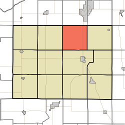 Location in Pulaski County | |
| Coordinates: 41°07′39″N 86°38′27″W / 41.12750°N 86.64083°WCoordinates: 41°07′39″N 86°38′27″W / 41.12750°N 86.64083°W | |
| Country |
|
| State |
|
| County | Pulaski |
| Government | |
| • Type | Indiana township |
| Area | |
| • Total | 36.38 sq mi (94.2 km2) |
| • Land | 36.38 sq mi (94.2 km2) |
| • Water | 0 sq mi (0 km2) 0% |
| Elevation | 719 ft (219 m) |
| Population (2010) | |
| • Total | 715 |
| • Density | 19.7/sq mi (7.6/km2) |
| ZIP codes | 46960, 46996 |
| GNIS feature ID | 0453311 |
Franklin Township is one of twelve townships in Pulaski County, Indiana, United States. As of the 2010 census, its population was 715 and it contained 284 housing units.[1]
Geography
According to the 2010 census, the township has a total area of 36.38 square miles (94.2 km2), all land.[1]
Unincorporated towns
- Beardstown at 41°08′17″N 86°36′09″W / 41.138097°N 86.602511°W
- Ripley at 41°06′02″N 86°39′37″W / 41.100596°N 86.66029°W
(This list is based on USGS data and may include former settlements.)
Adjacent townships
- California Township, Starke County (north)
- North Bend Township, Starke County (northeast)
- Tippecanoe Township (east)
- Monroe Township (south)
- Jefferson Township (southwest)
- Rich Grove Township (west)
- Wayne Township, Starke County (northwest)
Cemeteries
The township contains Mt. Zion Cemetery.
Major highways
Airports and landing strips
- Arens Field
- Graves Landing Strip
- Podell Airport
Landmarks
- Tippecanoe River State Park (northwest three-quarters)
Haschel Hill
Potowatami Indian Dam (located just up from the state park landing in the Tippecanoe River).
Winamac Fish & Wildlife Area (containing the old Patti Hills)
PCRM Headquarters
Firetower (located in the state park)
Hilljack-Clemons Hill (just west of Ripley)
Oxbow Lagoon (swampy lake created by a change in the Tippecanoe River many years ago -located in the state park).
Dead Bayou (located approximately 1/4 mile north of the state park boat landing merging with the river on the east side).
School districts
- Eastern Pulaski Community School Corporation
Political districts
- Indiana's 2nd congressional district
- State House District 20
- State Senate District 5
References
- United States Census Bureau 2008 TIGER/Line Shapefiles
- United States Board on Geographic Names (GNIS)
- IndianaMap
- ↑ 1.0 1.1 "Population, Housing Units, Area, and Density: 2010 - County -- County Subdivision and Place -- 2010 Census Summary File 1". United States Census. Retrieved 2013-05-10.
External links
 |
Wayne Township, Starke County | California Township, Starke County | North Bend Township, Starke County | |
| Rich Grove Township | |
Tippecanoe Township | ||
| ||||
| | ||||
| Jefferson Township | Monroe Township |
| |||||||||||||||||||||||||