Frankland River
| Frankland River | |
|---|---|
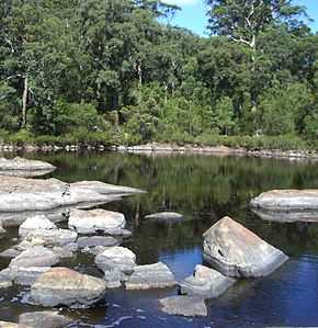 Circular Pool Frankland River | |
| Origin | Below Trollup Hill |
| Mouth | Nornalup Inlet |
| Basin countries | Australia |
| Length | 162 kilometres (101 mi) [1] |
| Source elevation | 215 metres (705 ft)[2] |
| Avg. discharge | 17.7 m³/s (558,000 Megalitres/year) |
| Basin area | 5722 km² [3] |
The Frankland River is a river in the great southern region of Western Australia. The Frankland River is the largest river by volume in the region and the eighth largest in the state.[4]
Mt Frankland was named in December 1829 by naval ship's surgeon Thomas Braidwood Wilson after the Surveyor General of Van Dieman’s Land George Frankland. Wilson explored the area in company with the Noongar Mokare from King George Sound, John Kent (officer in charge of the Commissariat at Frederick Town, King George Sound), two convicts and Private William Gough of the 39th Regiment, while his ship the Governor Phillip was being repaired at King George Sound.[5][6] The river was sighted by Captain Thomas Bannister in January 1831, and was named by Governor James Stirling when Bannister reported its existence to him.[7] Stirling's choice was influenced by Wilson's naming of Mt Frankland. The Frankland was apparently previously known by sealers as the Deep River.[1]
The Gordon River, a tributary of the Frankland river has its source south-west of the town of Broomehill. The other two smaller tributaries are Towerlup Brook and Ornabullup Creek. The Walpole, the Deep and the Frankland all flow into the Nornalup Inlet west of Walpole.
85% of the Frankland River's catchment, mostly about the 800 mm rainfall isohyet, is cleared for agriculture. The main land uses are cereal cropping and sheep grazing, with minor dairy farming, agroforestry, viticulture and olive farming.[8]
Salinity has increased in the river system with average values of 2 ppt in the 1970s to 1980s to 30 ppt since 2000.
References
- ↑ 1.0 1.1 Western Australian Land Information Authority. "History of river names". Retrieved 4 August 2008.
- ↑ "Bonzle Digital Atlas - Map of Frankland River, WA". 2008. Retrieved 24 November 2008.
- ↑ "South Coast River Care - Frankland". 2007. Archived from the original on 28 September 2007. Retrieved 1 August 2007.
- ↑ "Waterways WA - Strategies for Management to WA waterways". 2001. Retrieved 1 August 2007.
- ↑ Wilson, Thomas Braidwood (1835). Narrative of a Voyage Round the World. London: Sherwood Gilbert & Piper.
- ↑ Wilson, Thomas Braidwood (1833), "Extract of a letter received from Dr J.B. Wilson, R.N., dated King George's Sound, 15th December, 1829", in Cross, Joseph, Journals of Several Expeditions Made in Western Australia During the Years 1829, 1830, 1831 and 1832: Under the Sanction of the Governor, Sir James Stirling, London: J. Cross, p. 21
- ↑ Bannister, Thomas (1833), "A Report of Captain Bannister's Journey to King George's Sound, over Land, February 5th, 1831", in Cross, Joseph, Journals of Several Expeditions Made in Western Australia During the Years 1829, 1830, 1831 and 1832: Under the Sanction of the Governor, Sir James Stirling, London: J. Cross, p. 107
- ↑ MacCallum, Catherine (September 2004). "Landuse and tenure". Gordon-Frankland Catchment Compendium (pdf). Perth: Department of Environment. p. 1:11. ISBN 1-920947-39-6. Retrieved 14 August 2014.
Coordinates: 35°0′11″S 116°46′10″E / 35.00306°S 116.76944°E