Fram Strait

The Fram Strait is the deepest gateway to the Arctic Ocean located between Greenland in the West and Svalbard in the East, the latitudinal boundaries are roughly 81°N and 77°N. With depths up to 5.6 km[1] (in the Molloy Deep) it is the only deep connection between the Arctic Ocean and the world ocean, namely into the Greenland Sea and the Norwegian Sea. Other gateways are the Barents Sea Opening (BSO), the Bering Strait and various small channels in the Canadian Arctic Archipelago. They are all shallower or narrower than Fram Strait. The Fram Strait is named after the Norwegian ship Fram.
Oceanographic situation
Atlantic water
Atlantic water is a water mass originating in the Atlantic and transported northward by the West Spitsbergen Current in the East of the strait. The sub-surface flow has a strong seasonality with a minimal volume transport in winter. The relative warm Atlantic water also transports internal energy into the Arctic Ocean . The northward velocity is maximal in winter, the so-called heat transport is therefore highest in winter.
In the past century, the sea surface temperature at Fram Strait has on average warmed roughly 1.9°C (3.5°F), and is 1.4°C (2.5°F) warmer than during the Medieval Warm Period.
Polar water
The East Greenland Current flows southward on the Greenland Shelf. The water mass is relatively fresh.
Sea ice
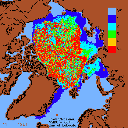
The Fram Strait area is located downwind of the Transpolar Drift and therefore covered by multi-year ice in the West of the strait, next to the coast of Greenland. Approximately 90% of sea ice exported from the Arctic is transported by the Eastern Greenland Current.[2]
The amount of sea ice passing through the Fram Strait varies from year to year and affects the global climate through its influence on thermohaline circulation. Sea ice essentially corresponds to fresh water, its salt content of 4 per mil compares to about 35 per mil for sea water.
Long-time observations
The Alfred Wegener Institute for Polar and Marine Research (AWI) and the Norwegian Polar Institute perform longterm monitoring studies in Fram Strait to obtain volume- and energy-budgets through this choke point. The observations also allow to assess the development of the Arctic Ocean as a sink for terrestrial organic carbon.[3] The AWI maintains a transect of up to 16 moorings across Fram Strait since 1997 with a longitudinal spacing of roughly 25 km. In up to five different depths, the water velocity is observed using rotor current meters. Additional CTD-sensors log the temperature and the salinity of the water column. The costs of a mooring are high (around 50 k€), but the most expensive part of the monitoring is the deployment and recovery of the moorings, a single day of RV Polarstern costs more than 50 k€.[4]
Past projects
The ASOF-N project aimed measure time-series of ocean fluxes between the Arctic and the Atlantic. Part of the work was performed at Alfred Wegener Institute.
Future plans
It is planned to convert combine biological measurements in the so-called AWI back yard (German: Hausgarten) with the oceanographic measurements within a future cabled observatory Frontiers in Marine Arctic Monitoring (FRAM). The main advantage is "unlimited energy supply for scientific instruments" and "real-time data" acquisition.[5]
Importance for climate
Computer simulations suggest that 60 to 70% of the fluctuation of the sea ice flowing through the Fram Strait is correlated with fluctuation of 6–7 years in which the Icelandic Low Pressure system extends eastward into the Barents Sea.[6] The warming in this area has likely amplified Arctic shrinkage, and serves as a positive feedback mechanism for transporting more internal energy to the Arctic Ocean.[7]
References
- ↑ Martin Klenke, Hans Werner Schenke: A new bathymetric model for the central Fram Strait. In: Marine geophysical researches 23, 2002, S. 367–378, doi:10.1023/A:1025764206736
- ↑ Woodgate 1999, Rudels 1999, cited in Gyorry 1999: The East Greenland Current
- ↑ "Fram Strait: an integrated signal of changes in the Arctic Ocean". Norwegian Polar Institute. Retrieved 26 September 2012.
- ↑ Schramm, Stefanie (2012-09-27). "Am Ende der Eiszeit". DIE ZEIT (in German). pp. 44–45.
- ↑ Klages, Michael. "Hausgarten - the Arctic Deep Sea Observatory". Helmholtz Association. Retrieved 1 October 2012.
- ↑ Top Story - Atmospheric wave linked to sea ice flow near Greenland, study finds - August 28, 2002. Gsfc.nasa.gov (2002-08-28). Retrieved on 2010-08-31.
- ↑ News, Science (January 28, 2011). "Warming North Atlantic Water Tied to Heating Arctic". ScienceDaily. Retrieved 31 January 2011.
- Daily Satellite Picture
- Temperature, salinity and volume fluxes in the Fram Strait
Coordinates: 78°0′N 0°0′W / 78.000°N -0.000°E