Fortescue River
| Fortescue River | |
|---|---|
 Ophthalmia Dam, Fortescue River | |
| Origin | Ophthalmia Range |
| Mouth | Indian Ocean |
| Basin countries | Australia |
| Length | 760 kilometres (472 mi) [1] |
| Source elevation | 602 metres (1,975 ft) [2] |
| Avg. discharge | 391 GL/year (mean) [3] |
| Basin area | 49,759 square kilometres (19,212 sq mi)[4] |
The Fortescue River is an ephemeral river in the Pilbara region of Western Australia. It is the third longest river in the state.
The river rises near Deadman Hill in the Ophthalmia Range about 30 km south of Newman. The river flows in a northerly direction parallel with the Great Northern Highway until it crosses the highway just south of the Marble Bar turn-off. The river then runs north-west then west crossing the Great Northern Highway again, north of the Auski Roadhouse. Approximately 100 kilometres (62 mi) north of Newman, the river flows through the 960 square kilometres (371 sq mi) Fortescue Marsh, an important wetland. The river continues to head west crossing Highway 1 at the Fortescue Roadhouse (21°17′44.32″S 116°08′17.52″E / 21.2956444°S 116.1382000°E) and discharges into the Indian Ocean at Mardie Station about 40 km south-west of Dampier
The river was named in 1861 during an expedition by the explorer and surveyor Francis Thomas Gregory, after Chichester Fortescue, Parliamentary Under-Secretary of State for the Colonies.
The traditional owners of the area that the river flows through are the Indjibandi peoples.[5]
Tributaries
The river is known to have 24 tributaries that include: Western Creek, Warrawanda Creek, Shovelanna Creek, Kalgan Creek, Fortescue River South, Cowcumba Creek, Macklin Creek and Tanga Tanga Creek.
During Cyclone Joan in 1975 many of these tributaries also flooded. Weeli Wolli Creek and Weelumurra Creek both overflowed and caused floods and washaways on the Hamersley Iron and Mount Newman railway lines.[6]
The river flows through a number of permanent water pools on the latter part of its journey including; Tarda Pool, Mungowarra Pool, Crossing Pool and Deep Reach Pool.
Catchment
The Fortescue Catchment area drains from the southern side of the Chichester Plateau and the northern side of the Hamersley Range making use of the trough between the two. The valley plains are composed of earthy clays with some cracking clays, loams and hard red soils.
Water is stored at Ophthalmia Dam which holds a total volume of 32,000ML, and a total of 6,290 ML/year are drawn from the surface water for use in the town of Newman.[7]
Fortescue Marshes
The catchment area at the headwaters of the river is particularly flat and marshy where the Western Creek, Warrawanda Creek and Fortescue River converge, the river then flow through a poorly defined channel as far as Gregory Gorge when the river starts to form a well defined channel and flows through a number of pools before reaching the estuarine area.
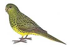
The 960 km2 Fortescue Marshes (22°26′44″S 119°26′38″E / 22.44556°S 119.44389°E} have been identified by BirdLife International as an Important Bird Area (IBA) because, when the area is flooded it supports up to 270,000 waterbirds, including over 1% of the world populations of 14 species. The site is also the location for one of the only two records made since 1990 of the critically endangered Night Parrot.[8]
Estuary
The mouth of the river is a large estuarine area. The estuary is mostly unmodified, and functions primarily as a result of river energy. The delta formed by the river is tide dominated. The estuary covers a total surface area of 23.3 square kilometres (9 sq mi) [9] The majority of the estuarine area is made up of salt marsh and intertidal flats. A colony of mangroves use the estuary as habitat and occupy an area of 1.2 square kilometres (0 sq mi). Large female Barramundi are known to inhabit the estuary.
References
- ↑ Western Australian Land Information Authority. "History of river names". Retrieved 11 October 2008.
- ↑ "Bonzle Digital Atlas - Fortescue River". 2006. Retrieved 11 October 2008.
- ↑ "Surface Hydrology of thePilbara Region". 2007. Retrieved 24 April 2009.
- ↑ "Australian Water Resources 2005 - Regional Water Resource Assessment – SWMA - Fortescue River". 2005. Retrieved 26 November 2008.
- ↑ "AusAnthrop Australian Aboriginal tribal database". 2009. Retrieved 5 May 2012.
- ↑ "Bureau of Meteorology - Severe Tropical Cyclone Joan". 2009. Retrieved 24 April 2009.
- ↑ "Australian Natural Resources Atlas - Water resources - Overview - Western Australia". 2007. Retrieved 24 April 2009.
- ↑ "IBA: Fortescue Marshes". Birdata. Birds Australia. Retrieved 22 June 2011.
- ↑ "Estuary Assessment Framework for Non-Pristine Estuaries Estuary 664 Fortescue River". 2006. Retrieved 24 April 2009.
Coordinates: 23°17′22″S 119°52′29″E / 23.28944°S 119.87472°E