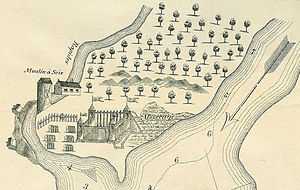
Fort de La Présentation
| Fort de La Présentation | |
|---|---|
| Ogdensburg, New York | |
|
Map of Fort de La Presentation | |
| Type | Fort |
| Site information | |
| Controlled by | New France |
| Site history | |
| Built | 1749 |
| In use | 1749-1760 |
| Battles/wars | |
|
Fort de La Présentation Site | |
 | |
| Location | Lighthouse Point, near Ogdensburg, New York |
| Coordinates | 44°41′44″N 75°30′03″W / 44.69556°N 75.50083°WCoordinates: 44°41′44″N 75°30′03″W / 44.69556°N 75.50083°W |
| Area | 23.75 acres (9.61 ha) |
| Governing body | Private |
| NRHP Reference # | 10000944[1] |
| Added to NRHP | November 26, 2010 |
In 1749, the French Sulpician priest, Abbé Picquet, built a mission fort, which he named Fort de La Présentation (Fort of the Presentation). It was also sometimes known as Fort La Galette. It was built at the confluence of the Oswegatchie River and the St Lawrence River in Canada. The French wanted to strengthen their alliance with the powerful Iroquois, as well as convert them to Catholicism. With increasing tensions with Great Britain, they were concerned about their thinly populated Canadian colony.[2]
By 1755 the settlement included 3,000 Iroquois residents loyal to France, in part because of the fur trade, as well as their hostility to encroachment by British colonists in their other territories. By comparison, Montréal had only 4,000 residents.[2]
In 1758, with the Seven Years' War intensifying, a French-Canadian military commander took charge of a garrison at the fort. In 1759, French military forces abandoned the fort to move to Fort Lévis. Ultimately the British besieged that fort and Montreal.
After the British victories of 1760, the French ceded their Canadian territory to Great Britain. The British renamed it Fort Oswegatchie. It remained under their control until 1796, after Jay's Treaty, when redefinition of the northern boundary caused the land to be taken over by the United States. The first settlement under an American flag began that year. American residents named the town Ogdensburg after early settler Samuel Ogden.
Fort de La Présentation site
The Fort de La Présentation Site is an archaeological site located on Lighthouse Point, near Ogdensburg, St. Lawrence County, New York. It encompasses the remains of at least eight different and discrete potential components, as identified in 1987–88. These include four contributing components: remains from French and Native American occupation during the period 1749 to 1760; remains from English and Native American occupation during the period 1760 to 1796; remains from American settlers in Ogdensburg during the period 1796 to 1812; and remains from American military occupation during the War of 1812.[3]
The site was listed on the National Register of Historic Places in 2010.[1]
References
- ↑ 1.0 1.1 "National Register of Historic Places". WEEKLY LIST OF ACTIONS TAKEN ON PROPERTIES: 5/31/11 THROUGH 6/03/11. National Park Service. 2011-06-10.
- ↑ 2.0 2.1 "History", Friends of Fort de La Présentation Website, accessed 2 Feb 2010
- ↑ Travis Bowman (May 2009). "National Register of Historic Places Registration: Fort de La Présentation Site". New York State Office of Parks, Recreation and Historic Preservation. Retrieved 2012-08-05. See also: "Accompanying six photos".
External links
- "Francois Picquet", the Dictionary of Canadian Biography Online
| |||||||||||||||||||||||||


