Fort Jennings, Ohio
| Fort Jennings, Ohio | |
|---|---|
| Village | |
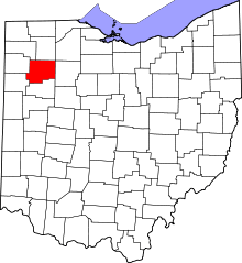
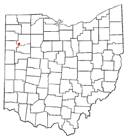 Location of Fort Jennings, Ohio | |
| Coordinates: 40°54′17″N 84°17′53″W / 40.90472°N 84.29806°WCoordinates: 40°54′17″N 84°17′53″W / 40.90472°N 84.29806°W | |
| Country | United States |
| State | Ohio |
| County | Putnam |
| Area[1] | |
| • Total | 0.53 sq mi (1.37 km2) |
| • Land | 0.52 sq mi (1.35 km2) |
| • Water | 0.01 sq mi (0.03 km2) |
| Elevation[2] | 745 ft (227 m) |
| Population (2010)[3] | |
| • Total | 485 |
| • Estimate (2012[4]) | 476 |
| • Density | 932.7/sq mi (360.1/km2) |
| Time zone | Eastern (EST) (UTC-5) |
| • Summer (DST) | EDT (UTC-4) |
| ZIP code | 45844 |
| Area code(s) | 419 |
| FIPS code | 39-27818[5] |
| GNIS feature ID | 1048750[2] |
Fort Jennings is a village in the southwestern corner of Putnam County, Ohio, United States. The population was 485 at the 2010 census.
Geography
Fort Jennings is located at 40°54′17″N 84°17′53″W / 40.90472°N 84.29806°W (40.904854, -84.298023).[6]
According to the United States Census Bureau, the village has a total area of 0.53 square miles (1.37 km2), of which 0.52 square miles (1.35 km2) is land and 0.01 square miles (0.03 km2) is water.[1]
Demographics
2010 census
As of the census[3] of 2010, there were 485 people, 194 households, and 132 families residing in the village. The population density was 932.7 inhabitants per square mile (360.1/km2). There were 207 housing units at an average density of 398.1 per square mile (153.7/km2). The racial makeup of the village was 99.2% White and 0.8% Asian.
There were 194 households of which 32.5% had children under the age of 18 living with them, 56.7% were married couples living together, 8.2% had a female householder with no husband present, 3.1% had a male householder with no wife present, and 32.0% were non-families. 30.4% of all households were made up of individuals and 18.5% had someone living alone who was 65 years of age or older. The average household size was 2.50 and the average family size was 3.17.
The median age in the village was 39.1 years. 27% of residents were under the age of 18; 7.4% were between the ages of 18 and 24; 23.7% were from 25 to 44; 24.9% were from 45 to 64; and 16.9% were 65 years of age or older. The gender makeup of the village was 47.8% male and 52.2% female.
2000 census
As of the census[5] of 2000, there were 432 people, 171 households, and 123 families residing in the village. The population density was 852.2 people per square mile (327.1/km²). There were 181 housing units at an average density of 357.1 per square mile (137.0/km²). The racial makeup of the village was 99.77% White and 0.23% African American.
There were 171 households out of which 33.9% had children under the age of 18 living with them, 62.0% were married couples living together, 6.4% had a female householder with no husband present, and 27.5% were non-families. 26.3% of all households were made up of individuals and 15.2% had someone living alone who was 65 years of age or older. The average household size was 2.53 and the average family size was 3.06.
In the village the population was spread out with 27.8% under the age of 18, 5.1% from 18 to 24, 28.7% from 25 to 44, 20.8% from 45 to 64, and 17.6% who were 65 years of age or older. The median age was 37 years. For every 100 females there were 94.6 males. For every 100 females age 18 and over, there were 96.2 males.
The median income for a household in the village was $44,464, and the median income for a family was $53,393. Males had a median income of $37,750 versus $23,750 for females. The per capita income for the village was $20,169. About 2.3% of families and 1.5% of the population were below the poverty line, including none of those under age 18 and 9.0% of those age 65 or over.
History
On Sept. 21, 1812, Col. William Jennings, with his regiment of Kentucky riflemen, was ordered by Gen. W. H. Harrison to cut a road from Fort Barbee at St. Marys to a point midway between that place and Defiance, and there establish a fort. The post was completed on this site in October, 1812, and named in honor of its builder.
The road begun by Col. Jennings was later extended to Fort Winchester by Col. Poague, builder of Fort Amanda. The Auglaize River Valley then became a major supply artery for Harrison's army, operating to the Northwest. By boat and wagon in the summer and by sled in winter, troops and large quantities of army stores were moved through here to the scenes of the major actions.
The town of Ft. Jennings was founded in 1847.[7]
Even though the actual village of Fort Jennings wasn't founded until 1847, the town celebrated the its bicentennial of the fort's initial founding in 2012. The village celebrated with historians, decorated riflemen with muskets, as well as civilians who spoke with hundreds of visitors and explained what it was like to live and work 200 years ago among other things.
References
- ↑ 1.0 1.1 "US Gazetteer files 2010". United States Census Bureau. Retrieved 2013-01-06.
- ↑ 2.0 2.1 "US Board on Geographic Names". United States Geological Survey. 2007-10-25. Retrieved 2008-01-31.
- ↑ 3.0 3.1 "American FactFinder". United States Census Bureau. Retrieved 2013-01-06.
- ↑ "Population Estimates". United States Census Bureau. Retrieved 2013-06-17.
- ↑ 5.0 5.1 "American FactFinder". United States Census Bureau. Retrieved 2008-01-31.
- ↑ "US Gazetteer files: 2010, 2000, and 1990". United States Census Bureau. 2011-02-12. Retrieved 2011-04-23.
- ↑ "Fort Jennings Marker". The Historical Marker Database. Retrieved 17 August 2012.
External links
- Howe, Henry (1888). "Putnam County". Historical Collections of Ohio I. Columbus, Ohio: Henry Howe and Son. p. 383.
- James A. Green, Ohio History (journal), Volume 38, " A Visit in 1929 to the Sites, in Western Ohio, of Forts Built by Generals Arthur St. Clair, Anthony Wayne and William Henry Harrison", Chapter VI, p. 614-616
- Origins of a Farmer-Soldier Tradition: The Jennings of Brookfield by Nicholas Hollis
| |||||||||||||||||||||||||