Forest of Bere


The Forest of Bere is a mixed-use partially forested area immediately north of Fareham, Portsmouth and Roman Road, Havant and includes a small part of the South Downs National Park.[1] [2] The former uninterrupted forest is today a mix of woodland, open space, ponds, streams, heathland, farmland and downland interspersed by minor villages and the major settlements of Waterlooville (with Cowplain) and Eastleigh (with Chandlers Ford).[3] It provides countryside access to the residents of South-East Hampshire having a number of paths and bridleways for walking and cycling. In particular in the southern portion, towards the area south of the Queen Elizabeth Country Park in the 20th century conifer plantations have been planted.
History
This royal forest was centuries before the late 17th century heavily wooded with agricultural clearings and covered an area stretching from the River Test at King's Somborne in the west through Hursley, Eastleigh (including Chandler's Ford), Bishop's Waltham, Denmead, Waterlooville to Rowland's Castle and the River Ems, Emsworth by the Sussex Border Path in the east. The forest was used a source of oak for the navy to use in shipbuilding.[3]
Woodland habitats and contiguous Country Parks
Listed from east to west, excluding small copses and coppices
- Southleigh Forest
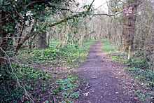
- Staunton Country Park
- The Holt with Stein Wood and Havant Thicket
- Bells Copse
- Outhills Copse with Stakehills Coppice and Beech Wood
- Bushy Lease with Neville's Park and Littlepark Wood
- The Queen's Inclosure in Waterlooville
- Newlandsmoor Coppice with Malin's Coppice, Drivett's Coppice, Portland Coppice, Potwall Coppice, Broomground Coppice and Greathunt Coppice
- Dunsland Coppice with Wards Coppice and Fareham Garden (wood that adjoins above group)
- Sawyer's Wood
- Creech Woods
- Place Wood
- Mitchelland Copse
- Stroud Coppice
- Hipley Copse
- Waltonheath Plantation with Ashlands Plantation and Staplecross Copse
- Goathouse Copse with Russell Copse and Kiln Wood
- Grub Coppice with Mill Coppice
- West Walk (one of the largest woods) (with Lowerfield Copse and Upperfield Copse)
- Dirty Copse with Great Holywell Copse
- Mill Copse with Hoegate Commons, The Purlieu and Huntbourn Wood
- Orchard Copse with Birching Copse
- Close Wood and Bishop's Wood
- Shaftesbury Copse, Aylesbury Copse with Ravens Wood, Birchfield Copse, Dash Wood, Dandy Copse and Fiddlers Green
- Mushes Coppice with Everitts Coppice, Stonyfield Copse, Flagpond Copse, Sager's Moor, Dimmock's Moor, Ridge Copse, Blackmoor Copse, Waterclose Copse and Sawpit Copse
- Brook Wood with Horse Wood, Hallwood Copse, Mansfield High Wood, Hole Copse and Silford Copse
- Jacob's Croft, Hangman's Copse, Blacklands Copse, Birch Row, Alder Moor, Maids' Garden Copse and Botley Row (wood that adjoins above group)
- Gull Coppice and Bushy Land, in Swanwick
- Wellspring Copse with Swanwick Wood
- Manor Farm Country Park with Dock Copse, Catiland Copse, Vantage Copse and Durncombe's Copse
- Netley Common with Dumbleton's Copse
- Telegraph Woods with Beacon Hill Woodland Park
- Hog Wood with Milkmeads Copse, Vocus Copse, High Wood and/in Itchen Valley Country Park
- Home Wood with Smithys Wood, Cox's Rough, Hut Wood, Marshall's Rows, Spring Copse and Chilworth Common
- Otterbourne Park Wood and Pitmore Copse
- Home Copse, Long Copse and Rownhams Plantation
- The woods that cover most of Cranbury Park
- Windmill Copse
- Hocombe Plantation with Trodds Copse
- Broadgate Plantation
- Ampfield Wood with Neville's Copse, Amprield Plantation and Hursley Forest
References
- ↑ Map from the Ordnance survey
- ↑ http://www3.hants.gov.uk/ltp06-forest-bere-map.pdf Forest of Bere Map
- ↑ 3.0 3.1 Fareham Visitor Information