Forada, Minnesota
| Forada, Minnesota | |
|---|---|
| City | |
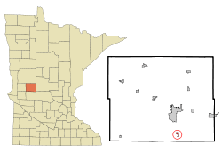 Location of Forada, Minnesota | |
| Coordinates: 45°47′26″N 95°21′12″W / 45.79056°N 95.35333°W | |
| Country | United States |
| State | Minnesota |
| County | Douglas |
| Area[1] | |
| • Total | 0.55 sq mi (1.42 km2) |
| • Land | 0.54 sq mi (1.40 km2) |
| • Water | 0.01 sq mi (0.03 km2) |
| Elevation | 1,417 ft (432 m) |
| Population (2010)[2] | |
| • Total | 185 |
| • Estimate (2012[3]) | 186 |
| • Density | 342.6/sq mi (132.3/km2) |
| Time zone | Central (CST) (UTC-6) |
| • Summer (DST) | CDT (UTC-5) |
| FIPS code | 27-21608[4] |
| GNIS feature ID | 0643791[5] |
| Website | http://www.foradadays.com/ |
Forada is a city in Douglas County, Minnesota, United States. The population was 185 at the 2010 census.[6]
History
In 1902, the Soo Line Railroad determined another station was needed between Glenwood and Alexandria. A surveyor was sent to acquire 75 acres (300,000 m2) for a town site located on the shore of beautiful, spring fed, Maple Lake, and known in the state for richness and natural beauty. The surveyor was given the privilege of naming the town. He wished to name it for his wife, Ada. There already was an Ada, Minnesota, so he named if For Ada. Thus, Forada was born.
Forada prospered for several years with two grocery stores, hardware store, hotel, doctor's office, blacksmith shop, saloon, drug store, photograph shop, lumber yard, stock yard, and the Forada Opera House.
As transportation improved, Alexandria and Glenwood flourished, but Forada's growth ceased. The people, many of who are descendants of the early settlers, had not given up. Forada was incorporated in 1905.
The railroad, now owned by Canadian Pacific, still runs through Forada many times a day en route to Northern Minnesota and Canada. There are now two successful bar/restaurants, a supper club used for many special events, a new bank, three resorts, a seasonal campground, a nine hole golf course, Volunteer Fire Department, First Responders, Lions Club, Senior Citizen's Club, 4-H club, Coffee Ladies Club, and the Forada Birthday Club.
Geography
According to the United States Census Bureau, the city has a total area of 0.55 square miles (1.42 km2), of which 0.54 square miles (1.40 km2) is land and 0.01 square miles (0.03 km2) is water.[1]
Minnesota State Highway 29 and County Highway 4 are two of the main routes in the community.
Demographics
2010 census
As of the census[2] of 2010, there were 185 people, 82 households, and 58 families residing in the city. The population density was 342.6 inhabitants per square mile (132.3/km2). There were 125 housing units at an average density of 231.5 per square mile (89.4/km2). The racial makeup of the city was 97.8% White, 0.5% Asian, and 1.6% from two or more races. Hispanic or Latino of any race were 1.1% of the population.
There were 82 households of which 23.2% had children under the age of 18 living with them, 56.1% were married couples living together, 12.2% had a female householder with no husband present, 2.4% had a male householder with no wife present, and 29.3% were non-families. 19.5% of all households were made up of individuals and 6.1% had someone living alone who was 65 years of age or older. The average household size was 2.26 and the average family size was 2.52.
The median age in the city was 50.8 years. 17.3% of residents were under the age of 18; 4.3% were between the ages of 18 and 24; 21.1% were from 25 to 44; 31.4% were from 45 to 64; and 25.9% were 65 years of age or older. The gender makeup of the city was 49.2% male and 50.8% female.
2000 census
As of the census[4] of 2000, there were 197 people, 82 households, and 63 families residing in the city. The population density was 370.5 people per square mile (143.5/km²). There were 118 housing units at an average density of 221.9 per square mile (86.0/km²). The racial makeup of the city was 100.00% White.
There were 82 households out of which 25.6% had children under the age of 18 living with them, 63.4% were married couples living together, 11.0% had a female householder with no husband present, and 22.0% were non-families. 14.6% of all households were made up of individuals and 7.3% had someone living alone who was 65 years of age or older. The average household size was 2.40 and the average family size was 2.63.
In the city the population was spread out with 20.8% under the age of 18, 6.6% from 18 to 24, 29.4% from 25 to 44, 27.4% from 45 to 64, and 15.7% who were 65 years of age or older. The median age was 43 years. For every 100 females there were 99.0 males. For every 100 females age 18 and over, there were 92.6 males.
The median income for a household in the city was $33,393, and the median income for a family was $34,286. Males had a median income of $23,750 versus $20,625 for females. The per capita income for the city was $16,736. About 7.4% of families and 5.4% of the population were below the poverty line, including 12.5% of those under the age of eighteen and none of those sixty five or over.
References
- ↑ 1.0 1.1 "US Gazetteer files 2010". United States Census Bureau. Retrieved 2012-11-13.
- ↑ 2.0 2.1 "American FactFinder". United States Census Bureau. Retrieved 2012-11-13.
- ↑ "Population Estimates". United States Census Bureau. Retrieved 2013-05-28.
- ↑ 4.0 4.1 "American FactFinder". United States Census Bureau. Retrieved 2008-01-31.
- ↑ "US Board on Geographic Names". United States Geological Survey. 2007-10-25. Retrieved 2008-01-31.
- ↑ "2010 Census Redistricting Data (Public Law 94-171) Summary File". American FactFinder. U.S. Census Bureau, 2010 Census. Retrieved 23 April 2011.
| |||||||||||||||||||||||||

Coordinates: 45°47′32″N 95°21′20″W / 45.79222°N 95.35556°W