Foel Cwmcerwyn
| Foel Cwmcerwyn | |
|---|---|
 | |
| Elevation | 536 m (1,759 ft) |
| Prominence | 344 m (1,129 ft) |
| Parent peak | Plynlimon |
| Listing | Marilyn, Council top |
| Translation | vat-valley hill (Welsh) |
| Pronunciation | Welsh: [ˈvɔil kʊmˈkɛɾwɪn] |
| Location | |
 Foel Cwmcerwyn | |
| OS grid | SN094311 |
| Coordinates | 51°56′44″N 4°46′29″W / 51.94566°N 4.77461°WCoordinates: 51°56′44″N 4°46′29″W / 51.94566°N 4.77461°W |
| Topo map | OS Landranger 145 |
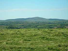
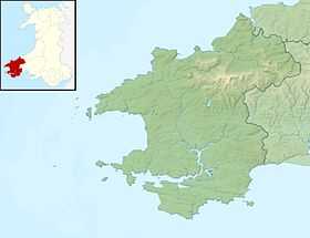
Foel Cwmcerwyn is the highest point of the Preseli Hills and of Pembrokeshire. It lies within the borders of the Pembrokeshire Coast National Park although it is 10 km from the sea. A path leads to the summit from the village of Rosebush in the south-west. A trig point and a number of cairns are dotted across the summit area, and there is a disused quarry on the hill's western slopes.
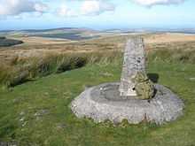
Summit of Foel Cwmcerwyn
External links
![]() Media related to Foel Cwmcerwyn at Wikimedia Commons
Media related to Foel Cwmcerwyn at Wikimedia Commons
- Computer generated summit panoramas Foel Cwmcerwyn index
- www.geograph.co.uk Photos of Foel Cwmcerwyn and surrounding area